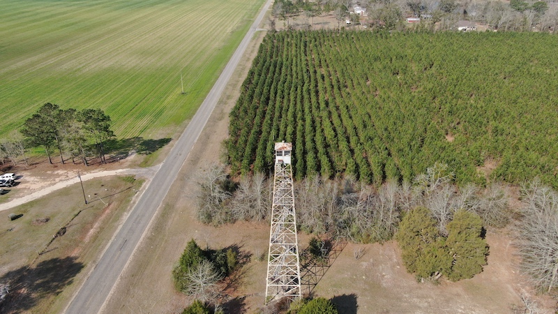
I have been fascinated with Fire Lookouts all of my life.
My Grandfather worked for the State of Alabama in the Forestry Division from 1933 till 1966. As a child I would sit in the tower with him on occasions and was enthralled with being in the tower and learning how it operated.
One of the things My Grandfather would do when I was with him was to pick out things that were visible and then get me to locate them on the map as if they were a smoke. A smoke was the way he defined that there was a fire. That was smoke on the horizon or rising up from some visible location from the tower. This was done by a method of triangulation. I guess it was a way to keep a what would have been a very bored child busy and it taught me a lot.
To determine the exact location of a smoke was needed for the ground crew to get to it to extinguish it.
In the center of the tower was a round map. The center of that map was where the tower was located. There was a rod on a swivel mounted on the center of the map and it would rotate 360° . This rod had sights on it similar to a rifle. Once a smoke was seen the Tower operator would sight the smoke with this device. Underneath this device was a pointer and it aligned with a metal band around the table that had the degrees of the Compass rose on it. What ever number this pointer was on was the compass direction the smoke was from the tower.
On the same map there was a small circle at the location of other towers on the map. There was a nail in the map that signified the exact location that tower. There was a Compass rose around those towers as well.
The tower operator would then contact the tower that would correspond to the area that would be able to see the smoke. They would exchange Compass headings on the smoke. Then the tower operator would take two strings one attached to the pivot in the center of the map and one attached to the nail on the other tower. He would then pull one string to the compass degree number he determined. then he would take the other trying and align it with the compass degree number determined by the other tower. Where the strings crossed on the map was the location of the smoke.
I have many fond memories of being in a tower.
I hope to be able to bring as many drone videos as possible to the internet for future generations to see before they are torn down and share as much knowledge as I can accumulate on these towers.