Fort Deposit, Alabama

As those of you that have followed me on Facebook and other means know that I am working on several projects. One being get a drone video of as many standing Forest Fire Lookout Towers that are still standing in Alabama as I can. Another project that I want to accomplish is to visit all 67 counties in Alabama. In those counties I like to document the buildings left standing that probably won’t be a decade from now. I also like to document as many churches as I can that I see. Most times it is the old country whitewashed ones standing out and away, but many of the others as well. Of course, I will photograph anything interesting, different, or historical.

As I say more times than not when I write, I photograph the decay of our beloved Southland not to point an accusing finger nor degrade any local areas but rather to bring awareness to what has happened, and the damage done. 

As is true with many I run into it bothers me to see what has happened to our great beautiful land. I try to shy away from politics and finger pointing as to the issues and rather to just show what has happened and allow those that see to make their own determinations. 

I know all of this sounds redundant, but I feel that it needs to be said over and over. 

Another decade and much of what we see in whatever forms of decay won’t be standing at all.

On this particular, trip my goal as to travel East from I-65 to the Georgia state line taking a zig zagging route pretty much North of Al. Hwy 10. This was to be my third trip across on this venture. The previous two trips had been across at lower levels with me working across one day, spending the night on the East side and working back West the second day. 

As I was planning a recent Ramble, I was looking at my maps. I was trying to make a determination on what route I wanted to take. As the paths across move northward it requires more driving over the same areas already covered to get to the starting point so to speak.

For whatever reason my eyes settled on Fort Deposit. I have been through what we all know as Fort Deposit on I-65 hundreds of times in my lifetime. I however, cannot say that I have ever visited the town of Fort Deposit other than many years ago I went to the Calico Fort Arts and Craft show a couple of different times. 

For whatever reason I honestly thought the town itself was on the East side of I-65 and not the West. 

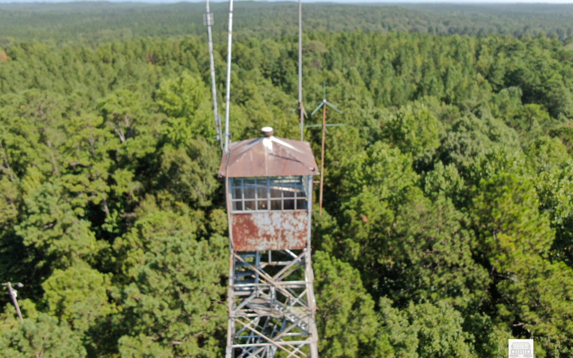
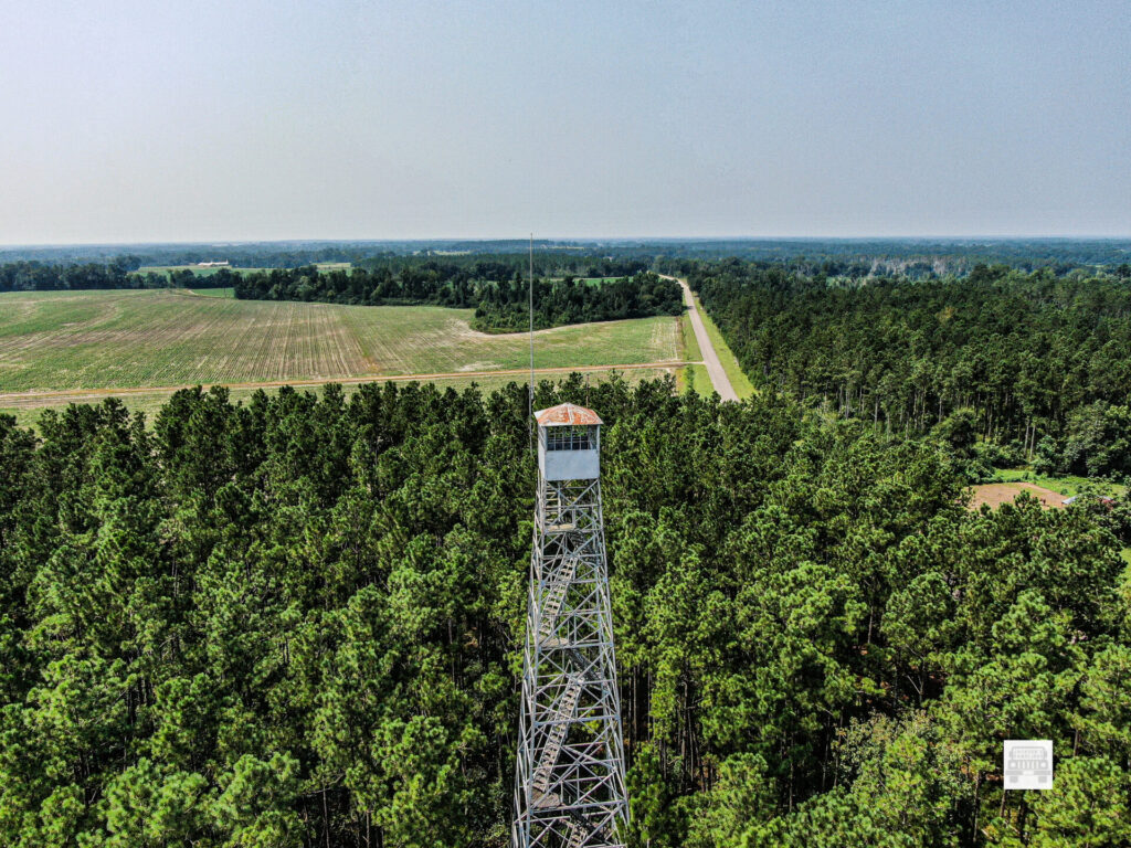
As my eyes settled on Ft. Deposit I started to settle on a route there taking the back roads. On this route I found Mt. Willing where a Fire Tower is still standing that I did not have photos of, so I could check something else off the list of things I Was working on. I actually wrote about that in an earlier post. https://jacksonsramblings.com/mt-willing-lookout-tower/.

Now as I drove the route up, and shot photos of various things, primarily old churches on the way up, and got the Fire Tower shots done, I made it to Fort Deposit.

According to Wikipedia: https://en.wikipedia.org/wiki/Fort_Deposit,_Alabama

Since 1890 it has been the largest town in Lowndes County, AL. According to the information on Wikipedia it grew from 2000 to 2010 but then declined between 2010 and 2020. I would venture to say from the appearance I saw it is declining sharply since 2020. I have no way of knowing that for sure and I honestly hope something changes to reverse that.

Reportedly the town sits on 5.6 square miles.

Fort Deposit was named for the fort built there under orders of General Andrew Jackson. It was a supply fort that was built to supply soldiers during the times of the Creek Indian Wars. It was incorporated February 13, 1891. It also is supposed to be the highest point between Montgomery, AL. and New Orleans, LA.

Again this information came from Wikipedia and is referenced there is anybody chooses to source it all out.

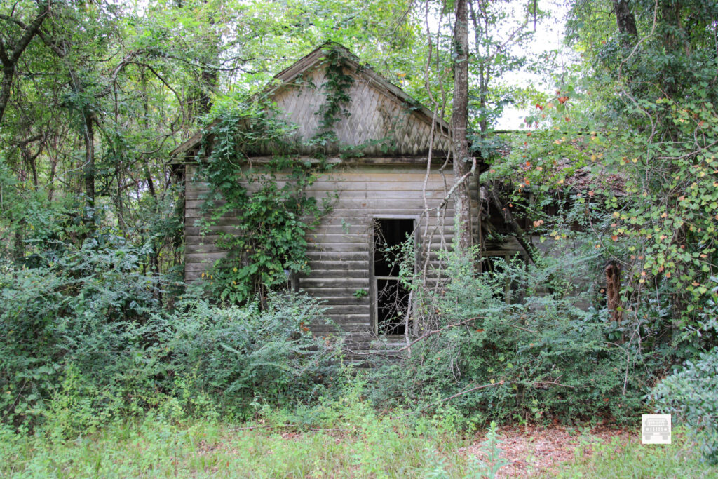
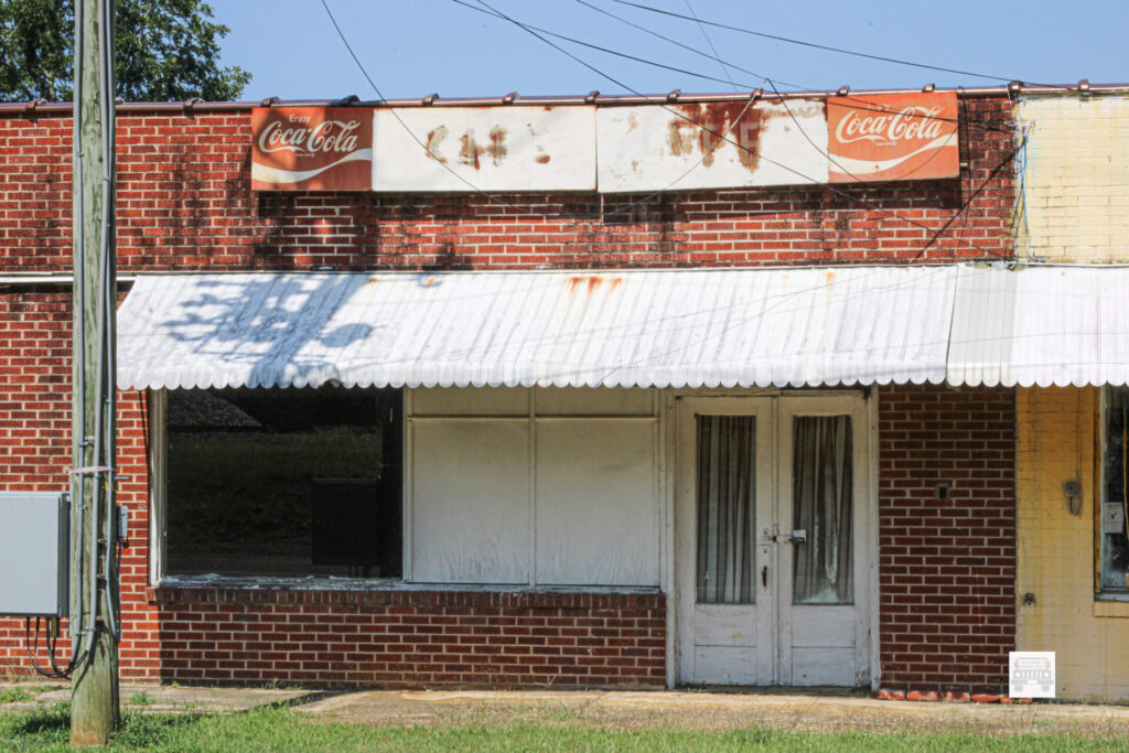
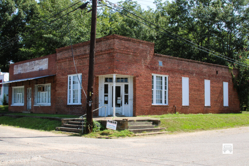
Now as I arrived in Fort Deposit I was not certain what I would see. From experience of traveling small old towns, I figured there would be some buildings that were vacant and in various stages of decay. Sadly, very seldom do I visit an older Southern Town do I not see that.

The very first thing I saw upon entering town was a gathering of people. Curious I slowed down and realized that it was a food giveaway. There were trailers with pallets of food that was being distributed. There was a line of cars with folks waiting in line to get food. This is a sight that is all too common across the country. I did not take time to even estimate how many cars there were nor how many people but I know that the length of the line was incredible to me. This added to my thoughts of how depressed our beloved Southland has become.

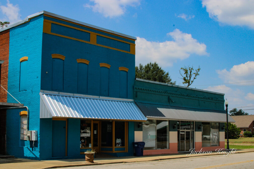
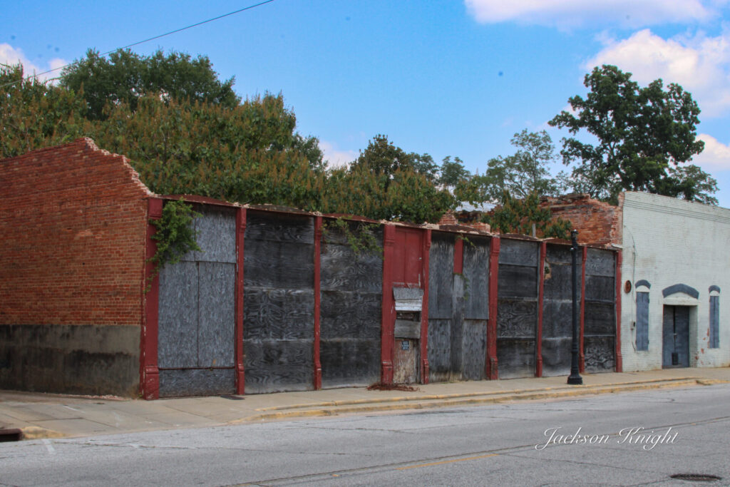
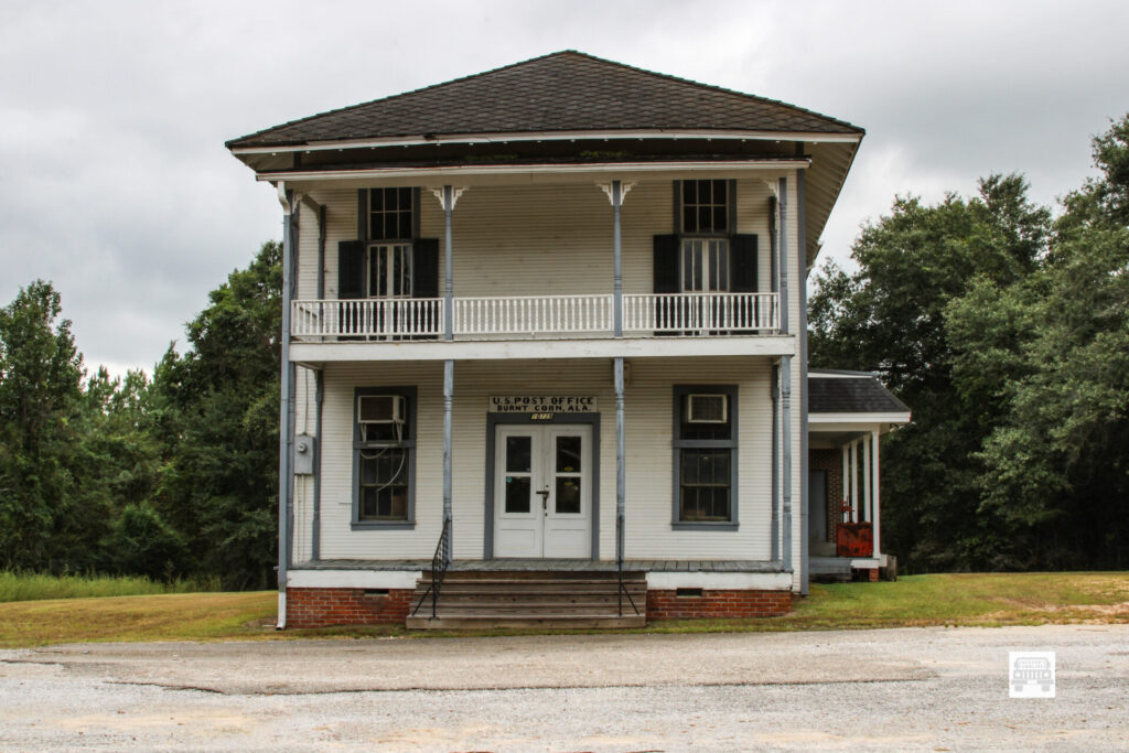
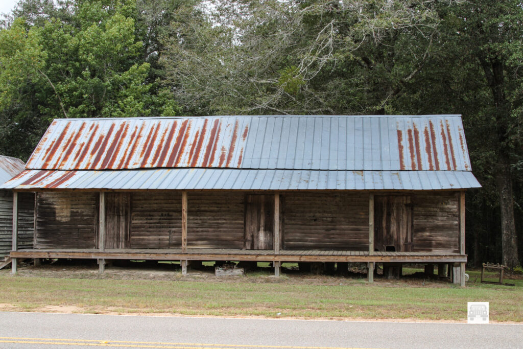
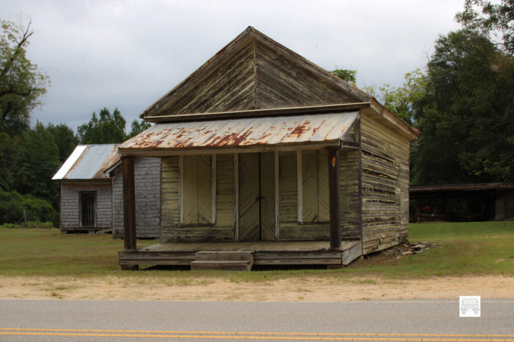
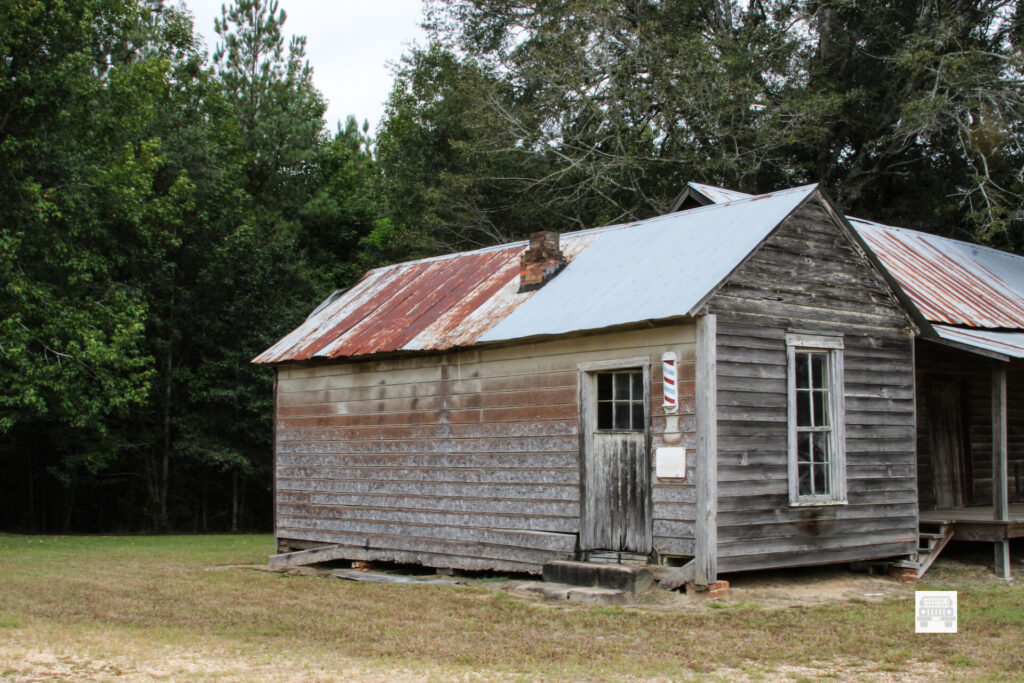
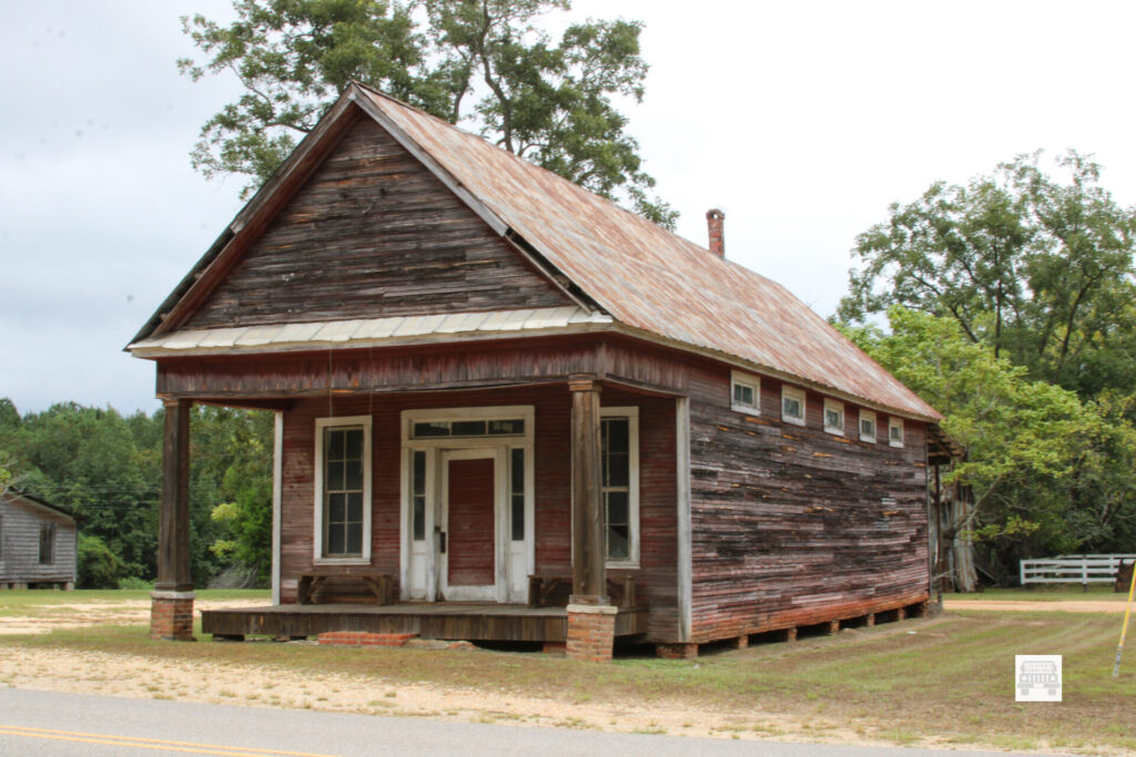
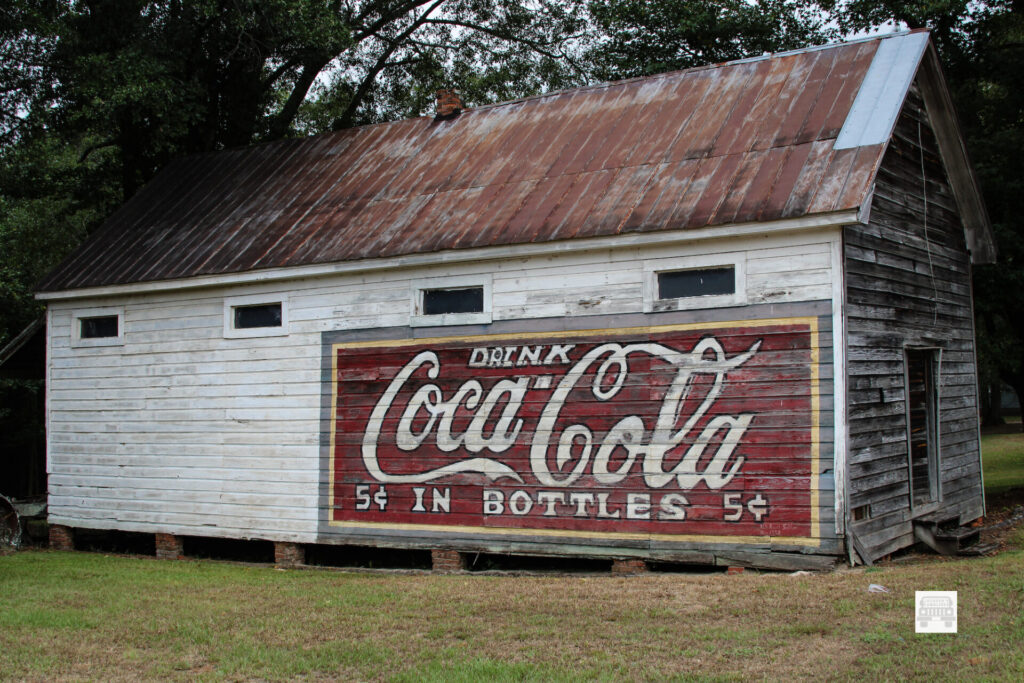
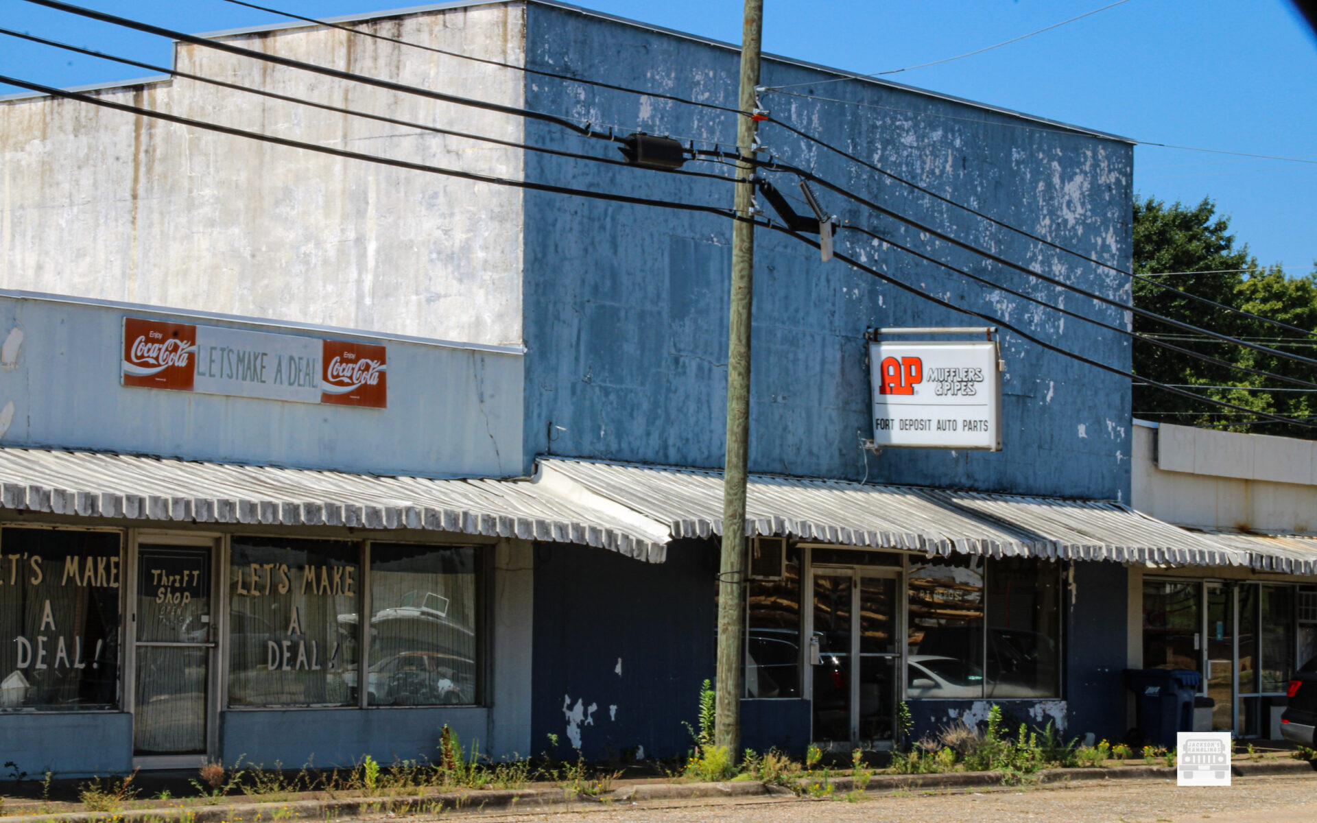
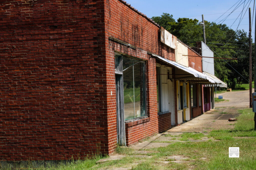
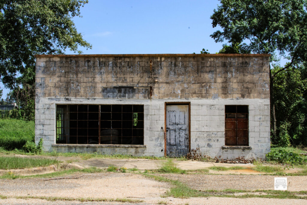
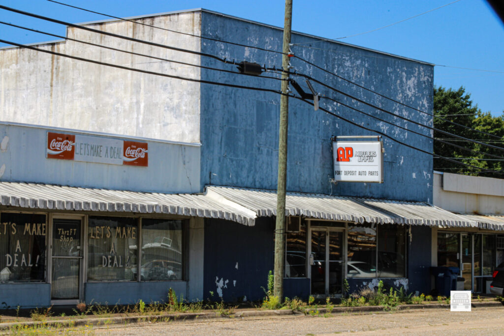
I rode around and took various pictures of the various places in town. This is a town that has suffered immensely. A once bustling beautiful town that is like hundreds if not thousands more across America that are nothing more than rotting down buildings. 

I say it every time I go into a town like this it breaks my heart. As I have seen on the various trips I have taken in the past and would see on this trip these towns are everywhere as I will write in blog posts to come.

Stores, post office buildings, doctor’s offices, churches, and many homes. So many times just sitting there deteriorating.

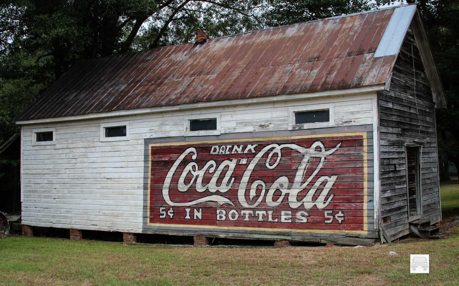
Many times, you can identify the place by the sign or remnants of a sign that is there still. Other times there is no sign and if a local does not fill you in you have no way of knowing what was there. Clothing stores, mom and pop grocery stores, all closed up. 

Overlooking the town there was a beautiful painted water tank. That is a sign of hope. It is a thing of beauty. As always that is still a sign of the future. I also saw numerous houses well kept up in the residential areas of town. That is a positive as well. Although the businesses were forced to close fortunately people are still able to. Live there. 

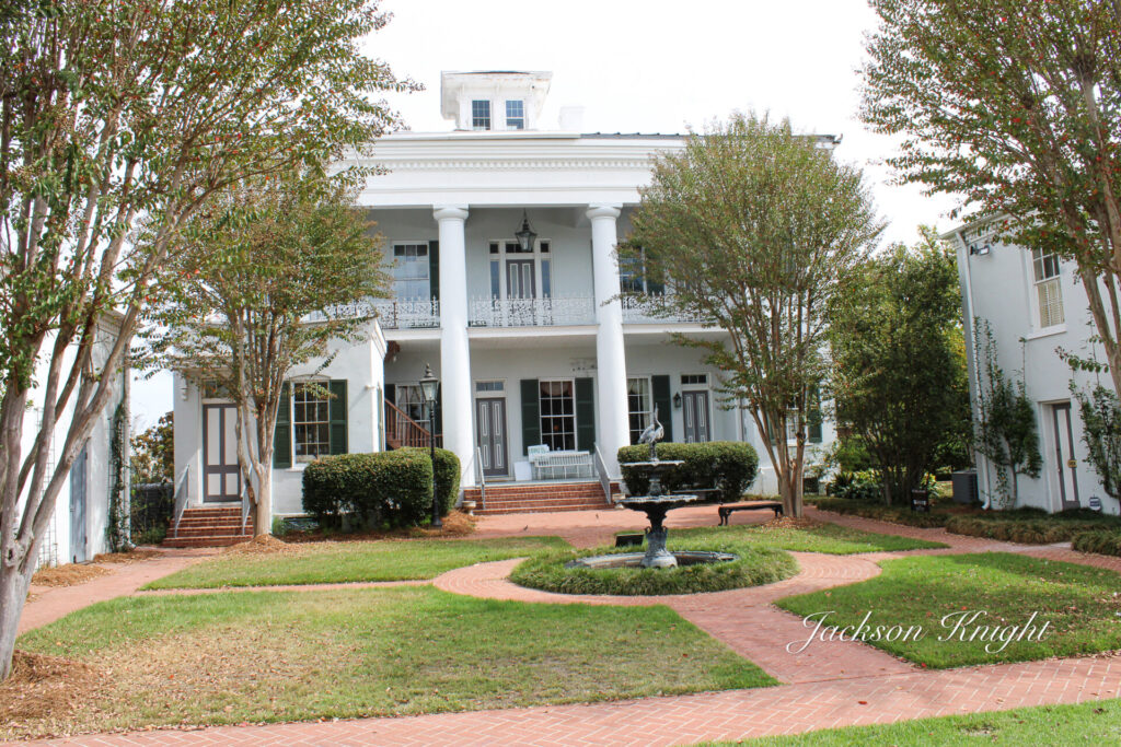
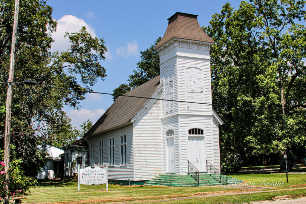
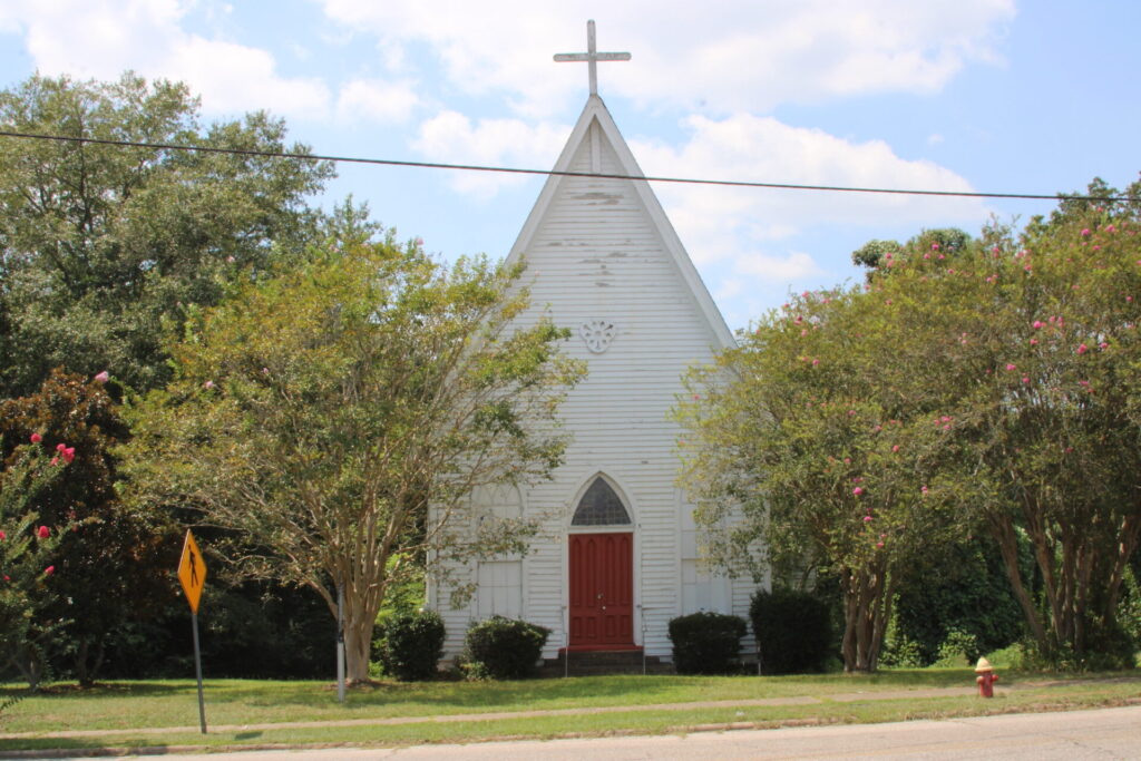
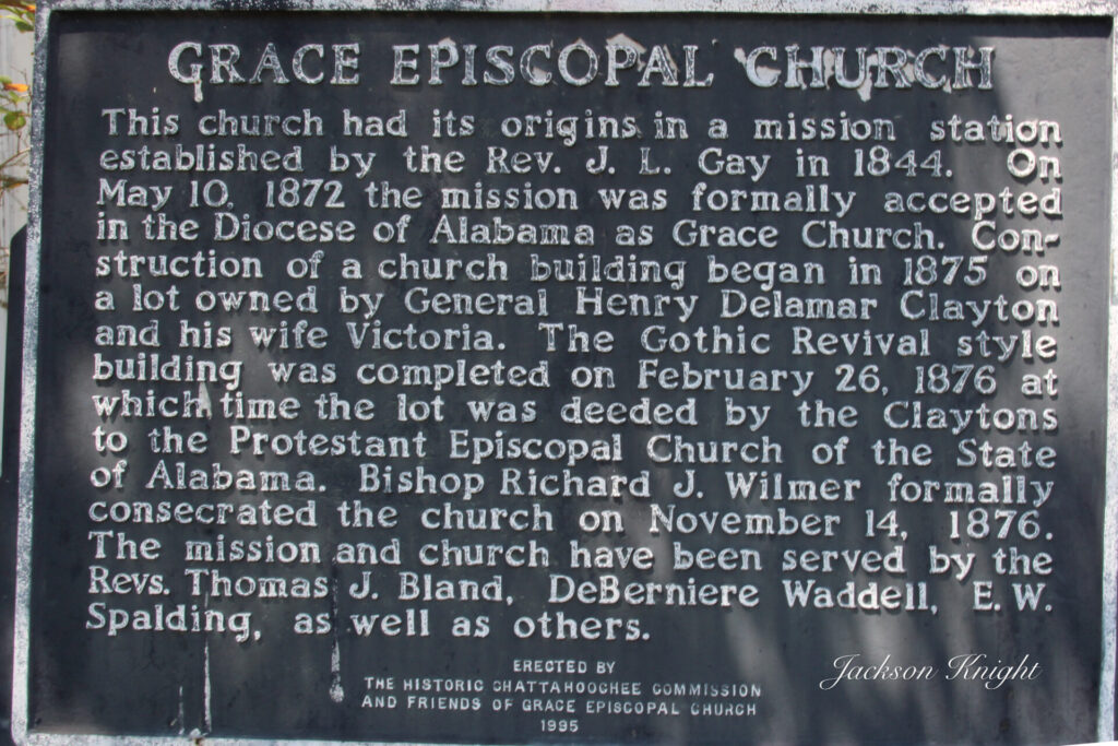
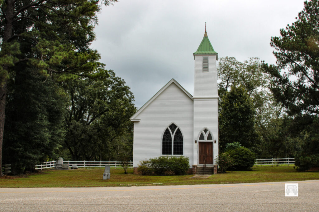
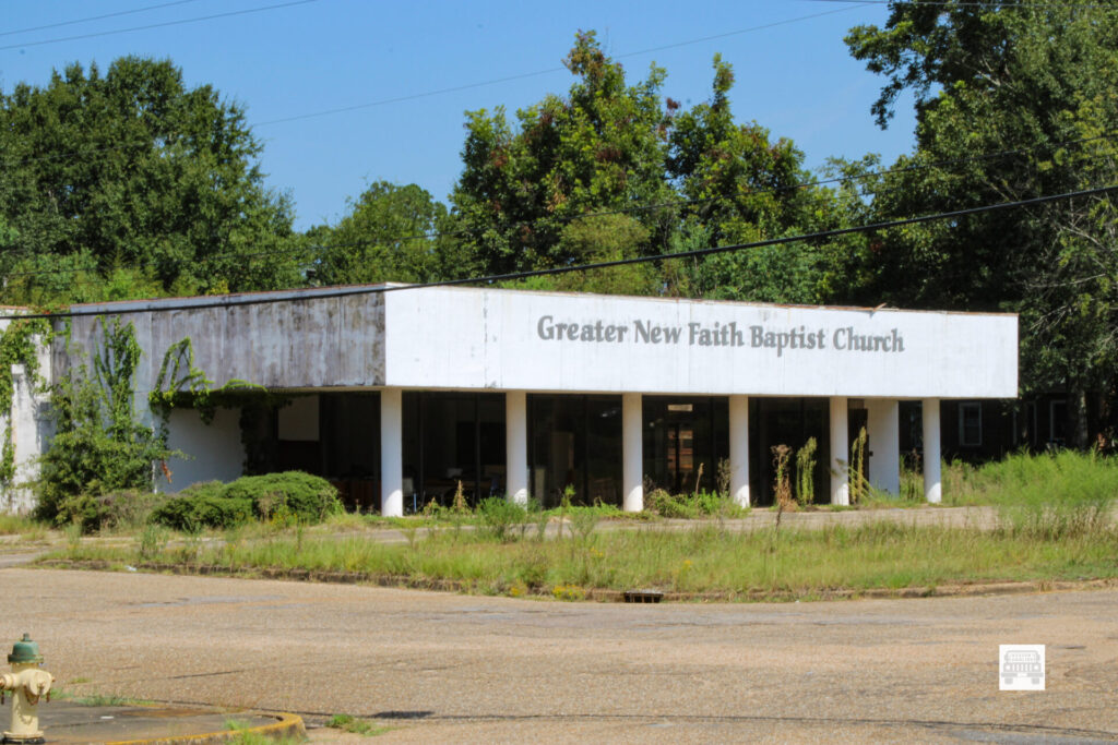
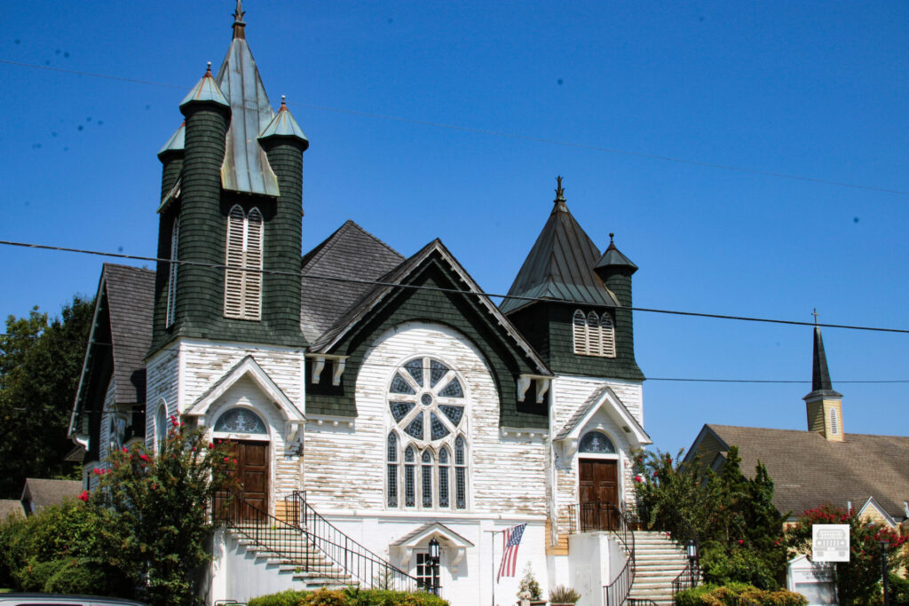
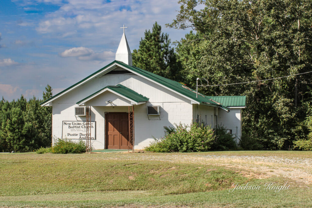
One beautiful thing to me was this beautiful church building. I hope somebody will chime and with comments and tell me all about it. It looks to me like it is going through some sort of renovation, which I think is awesome.

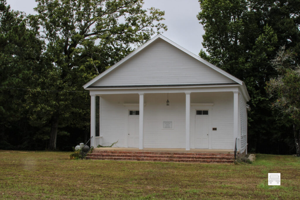
I saw other positive things here. There were other churches that were still kept. Even though there were many buildings that were empty or just there, there was life still in this town which I am glad to see.

Like so many of our southern neighbors this town will most probably be here many years to come and somehow I would not doubt it coming back to something of its former glory one day.

As always it was a pleasure to visit Fort Deposit, Alabama and hopefully I will see it again in the not too distant future and hopefully there will be signs of growth and comeback that are evident to all. 

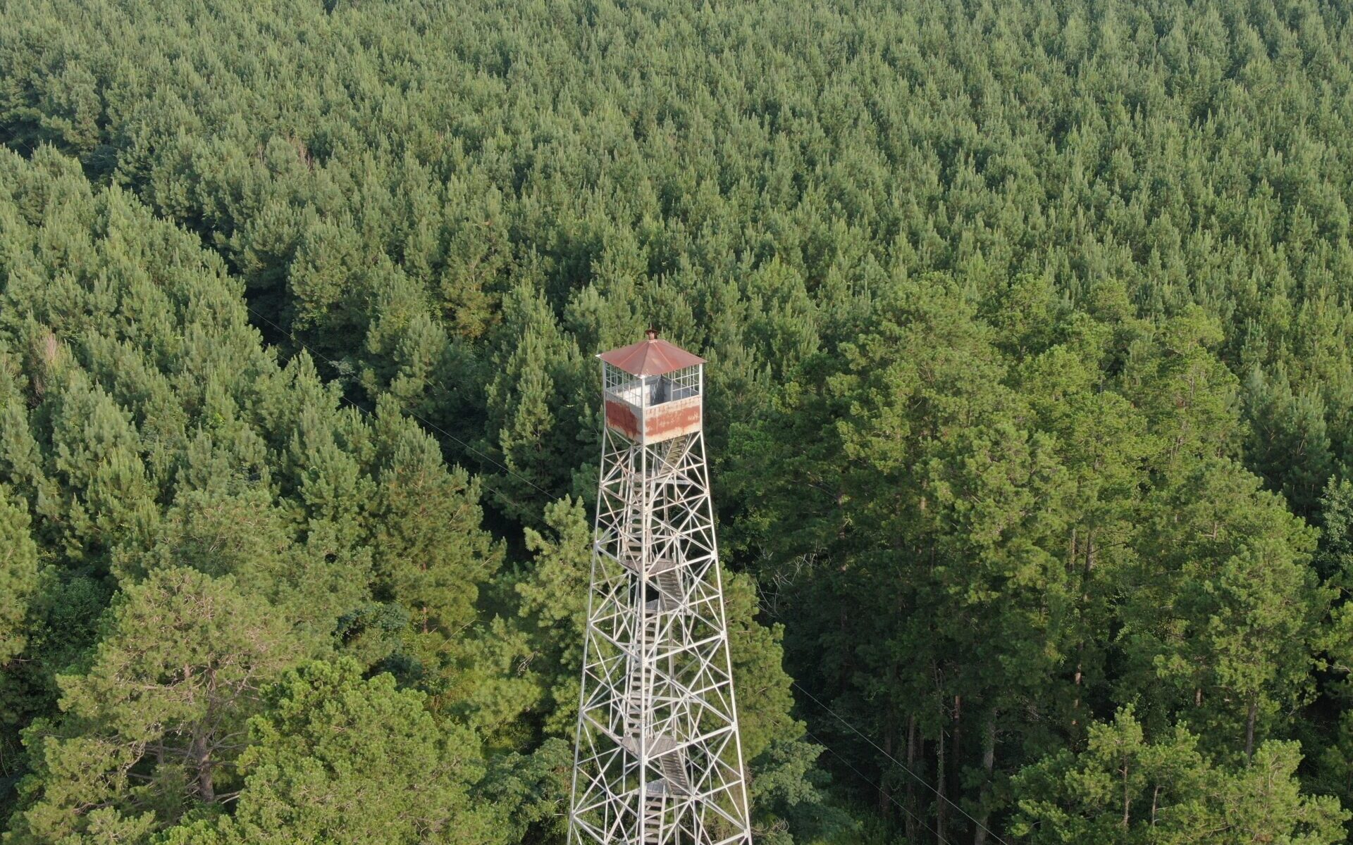
Mt. Willing Lookout Tower.

As most people know Forest Fire Lookouts is actually what got all of this started. Sort of.

I have been working on getting drone videos and pictures of them for years now. As most of you know it is my desire to document every one left standing in the State of Alabama. From the best of my estimation there are about 75 left.

Also to the best of my knowledge there have been only 4 that are South of US hwy 80 and West of I-65 that I have not been able to get to.

Two of those are behind gates and I have not successfully gotten the opportunity to get them. I just found out about one only a few weeks ago. That one is actually in the very Southern and Western most part of Mobile County. The fourth one has been up at Mt. Willing in Southern Lowndes County.

I have actually left home to get to Mt. Willing and for whatever reason never got there. You might say for me it has been elusive. I could not figure out exactly how to get to it even from the road. Now days so many roads that are few years ago were considered public roads are no longer open.

This morning I was coming across the area heading to Ft. Deposit and lo and behold I looked at my map and there was the pin for Mt. Willing Lookout Tower. I was going to be the closest to it I remember being.

I started looking at the maps as best I could trying to figure it out. Obviously when I needed it the most I did not have enough cell signal to figure it all out on the maps. I could figure out that I was not too far from it but could not figure out how to get to it.

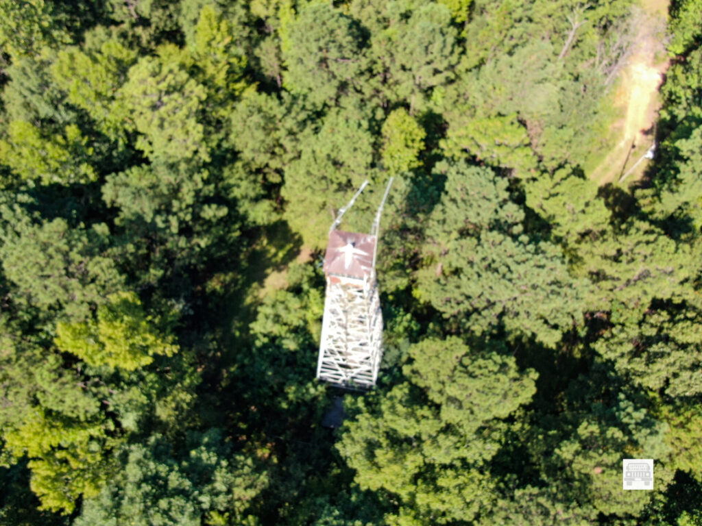
Then all of a sudden as I was looking off in the distance I could see it. There was a short distance across a clear cut but was like a window I would say that the tree line broke and I could see it off in the distance from the road.

Now I hold a current FAA Part 107 certificate to fly drones. I knew I could fly it but I needed to be able to maintain visual line of sight. I stood there and looked and looked trying to decide. Finally I decided to give it a try. I knew it was a stretch but if I could not hold sight I could just return the drone and give up till I figure out a better way.

I parked beside the road. Laid the landing pad out, started the drone and controller, and calibrated the compass on it, and took off. It was bright. It was hard to see the controller in the sunlight. I could see the drone all the way. 

One issue you have flying towers that far out is determining how close to the tower you really are. You are looking at a tiny screen in bright sunlight. Looking at the drone itself that far away it is just a dot basically and it is hard to look at two objects and determine exactly how far apart the really are.

default
default

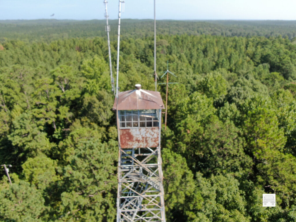
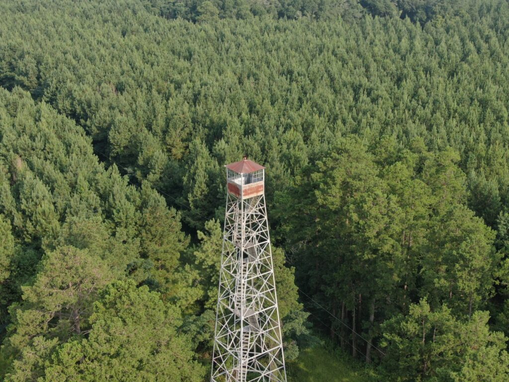
At a thousand feet out or so it is hard to determine if. You are 50 feet away or you are about to hit it. My drone has obstacle avoidance in it. I brought it in to where the obstacle avoidance started reading the distance. I was able to get some decent photos and a short video of it. 

Because of fear of losing sight of my drone I was not able to get as clear nor crisp pictures nor video as I do most towers. I was thankful though to get that one in the books as done.

The following information comes from the National Historical Lookout Registry:

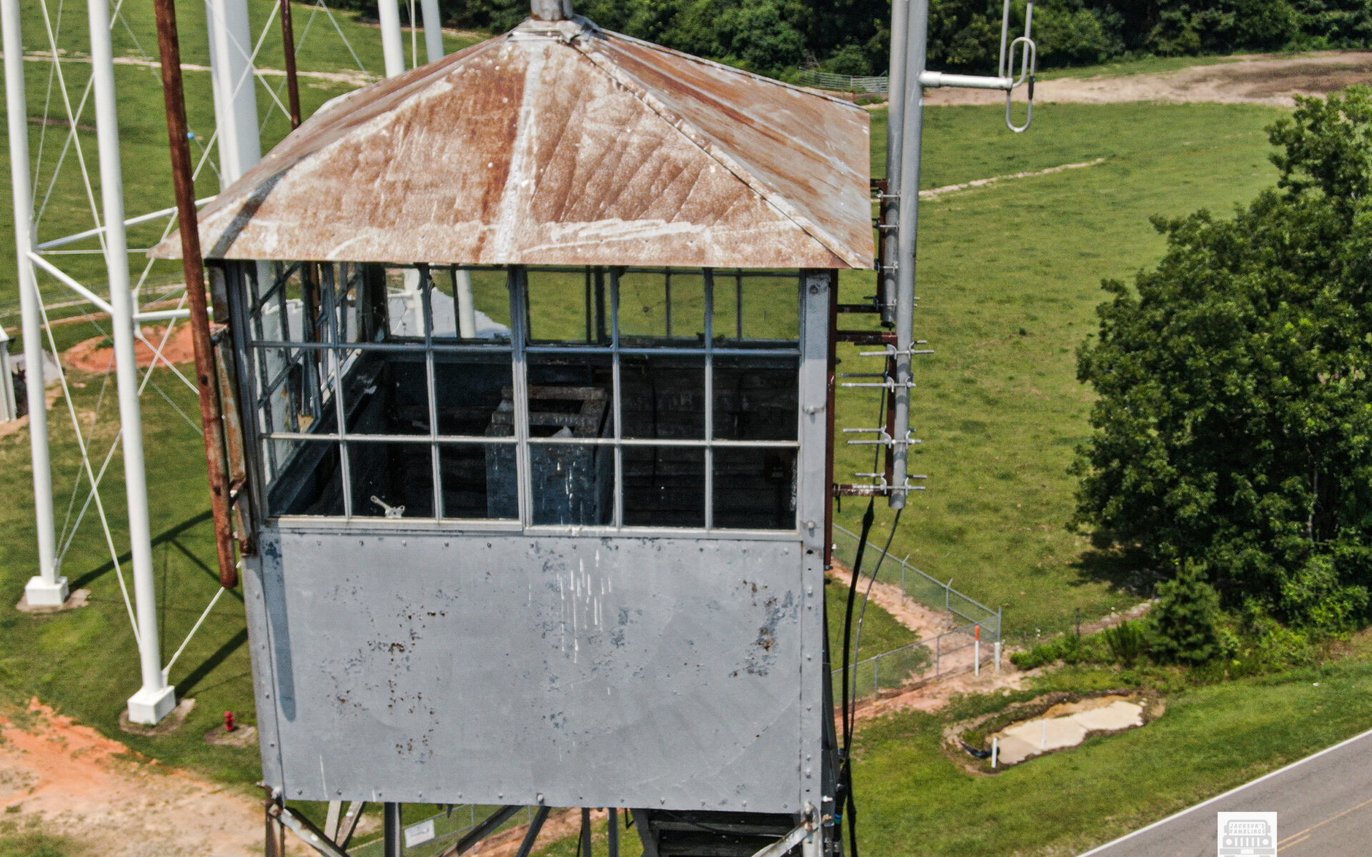
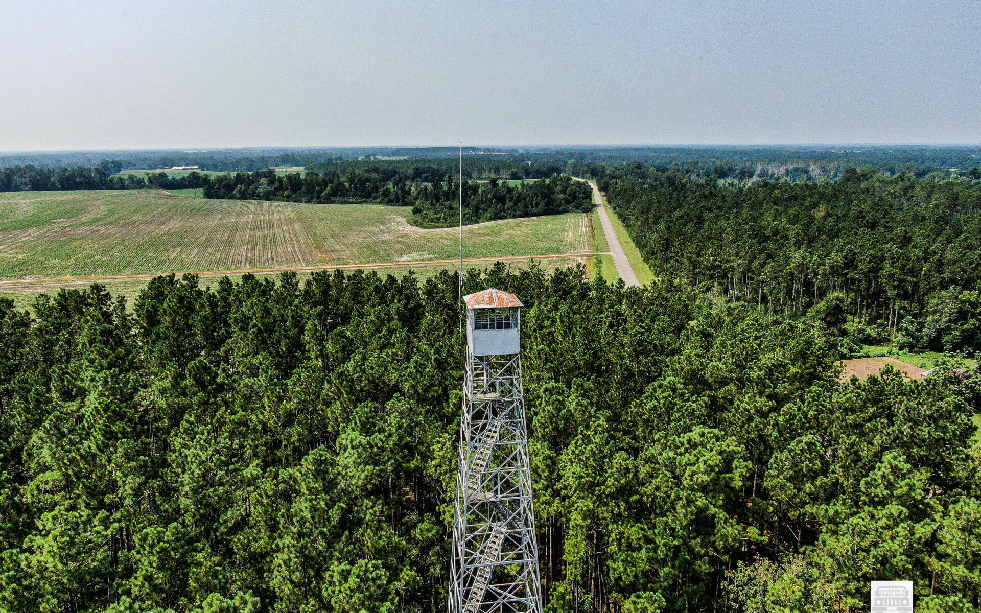
The Mount Willing Lookout Tower in Lowndes County dates to 1936. The 100′ Aermotor MC-39 steel tower with 7’x7′ cab was built by CCC Company 4434, which was also a junior African-American unit.

Mt. Willing is: # 857 on the US Registry and #36 on the Alabama Registry.

It is located:

32°04’22.5″N 86°43’07.1″W

32.072903, -86.718627

I am thankful that I finally found it and got to take some pictures of it. I like to get closer and I like to make better photos. I will make a video when I get time. I actually have several I need to make videos of that I have taken the videos but not taken time to edit and put them up.

Thanks for reading. Hope you enjoy.

Rambling The Southland

As many of you know that follow me on Facebook, and other sources online and even in person, I travel a lot. In fact, I have made it my mission to visit all 67 counties in Alabama within the next year. Somewhere in that timeframe I intend to visit a lot more of Mississippi as well.

More than one person has asked me why, are you doing that?

Well, it goes like this. As many who know me know, I have a fascination for history. Now at different times I have interest in different things. Plus, I have an overwhelming interest in photography. Now, put the two together and guess what you come up with? I have an almost unquenchable interest in taking photographs of things from the past.

Living in Monroe County, Alabama I have seen the towns of Frisco City, Repton, Peterman, Tunnel Springs, Beatrice and so forth pretty much dry up in my lifetime. I mean there are still people there but there are basically just rows of rotting down buildings that are for the most part falling in. I guess it had never even dawned on me that this was a problem in other places. Not sure why, but it just never seemed to really click.

As many know I also fly drones and love old Fire Towers. A couple of years ago I started on a project to locate and do a drone video of as many of those old Fire Towers as I could find. I don’t know why but even with that I had no clue as to how many were standing still in the State of Alabama nor the condition, they were in.

New Hope Church Natchez AL.
Bull Slough Bridge
Coaling Tower

As I started to travel and get photos of those towers. I also started to notice how many old churches that there are standing that are abandoned or are on the verge of being abandoned. It was like a light bulb went off in my head I guess you could say. It is like most small towns you go into there is one or two old churches normally that were founded in the mid to late 1800’s that are just sitting there.

Then as I rode through the towns, I was familiar with and for some reason I started to really notice how many buildings were vacant and rotting down it really started to hit me. These are going away fast. The buildings, the churches, and the fire towers. They are all going away at an alarming rate. 

That is when my mission I guess you would call it became clear to me. I am retired. I have less and less responsibilities. I have my health. I have decent vehicles, and I have decent equipment to document this stuff with. I am not wealthy by any stretch of the imagination but by managing reasonably well I have the resources to travel and do it. 

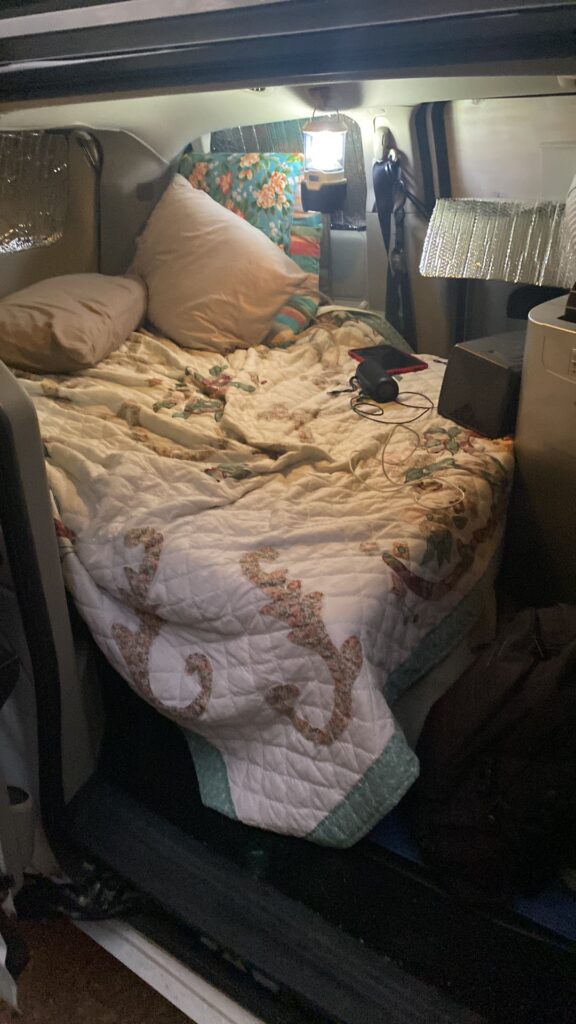
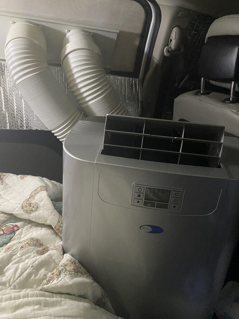
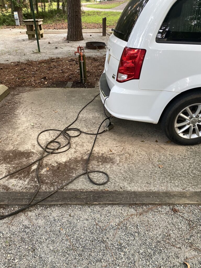
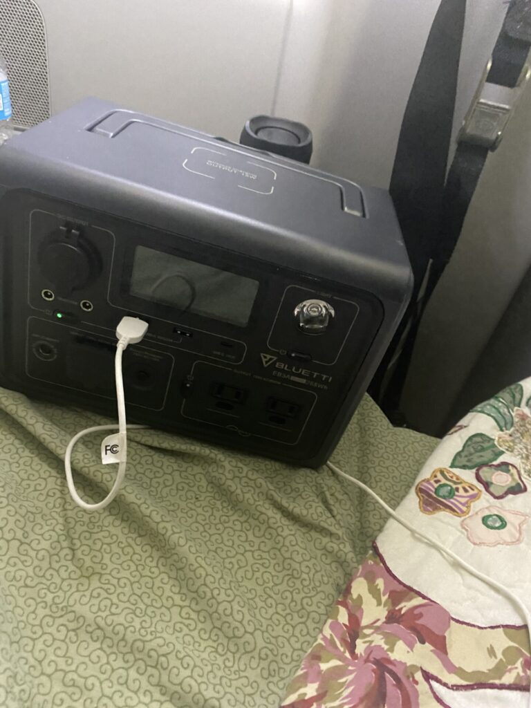
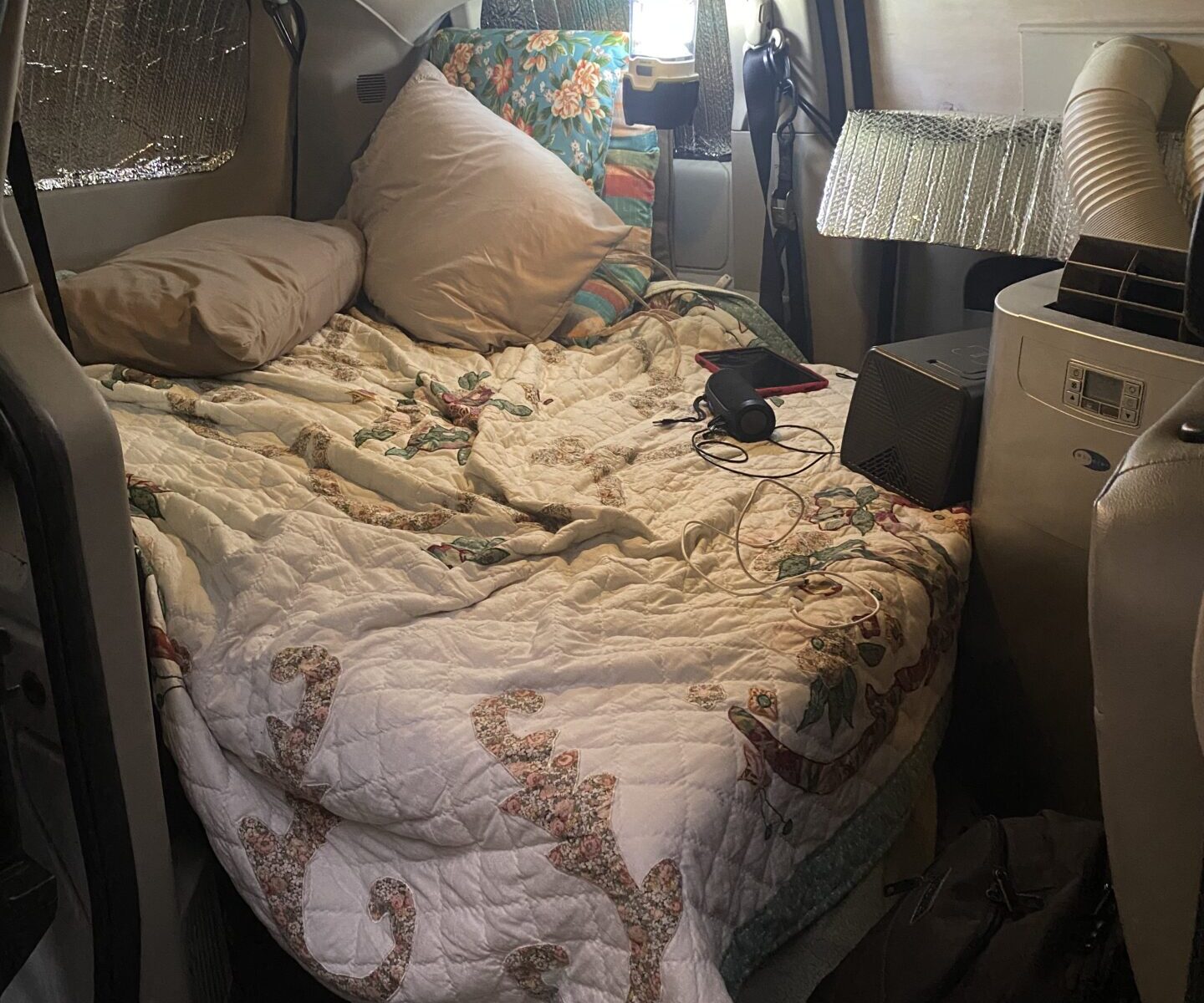
Here is my Dodge Caravan that is converted into a sleeper van. It has AC and an almost full sized bed so that I can sleep comfortably. I also have a small cooler sized refrigerator. It is quite comfortable and is ideal for most excursions.

So that leads me to where I am now. I am on a mission to travel our beloved Southland and document as much of it as I can. Churches, fire towers, stores, water towers, other places of business and anything else interesting I see along the way.

As many know I am the founder and moderator of the group “The Good Ole Days of Monroe County Al.”.  I love that group. It is a great group, and it has done well. It however as was created is for Monroe County Alabama and thus I wanted it to remain that way.

I quickly realized that doing what I wanted to do was going to cause me to do a lot out of Monroe County. One visit to Mississippi made me realize that it was going to be more than just Alabama. Thus, Jackson’s Ramblings came into being. Then my slogan, “Rambling the Southland and Beyond.” Well, that seemed to get it going. Then when I hit on a slogan, immediately I thought Facebook group. So, I named the Facebook Group, “Rambling the Southland and Beyond.” That way anything documented would fit the category.

There have been many contributors who have a like desire of photographing old, unusual, and or interesting things, that have shared and continue to share on the group. I hope that as time goes on that those and more will continue to share. If you area reading this and are one of those you are greatly appreciated.

At the time of this writing the group has 2740 or so members and is growing many weeks at the rate of 50 to 100 a week. It was created in June of 2022. My only hope is to see the group grow to how ever big it can grow. Tens of thousands would be incredible.

I also love to write. As those who take time to read my writing can readily see I have a lacking in writing skills. I aways joke and say that they only thing that kept me from doing great in high school was elementary school. I am the first to admit that I have issues with grammar and punctuation. However, I like to feel like that I make up for that with desire and determination.

With all of that said, there is a wealth of places, buildings, and other things that are standing today that in a very few years will no longer be standing. For the years I have left, and I hope it is a lot, I intend to take photos of those things, document them as best I can, and write about them as time allows. 

It would be incredible to be able to fund the travel, and equipment, to do this in some way while doing it. I do not have a large enough audience for any business or group to pay me sponsorship. My viewership on my blog is too small for the ads associated with it to make me money, or at least for this time. I have not updated my Youtube channel in a while as well. It takes a lot of time and effort to keep it all up. Some weeks I drive 500 plus miles or more. Sometimes I spend a night in my van some place to keep from having to stay in a hotel or drive home. Then there are hundreds of photos to look at figure out where they were taken, organize them and then file. It is a labor of love but also almost a full time job.

Hopefully in the future this can change. I plan to try to write more blog posts as I travel and interact more that way. Hopefully I can go back to doing more videos as well.

Thanks, to all who have supported me in this endeavor, and I look forward to meeting others along the way who have like interests.

Come join me as I Ramble the Southland and Beyond.

Houston Lookout Tower

31.105114, -85.151210

Al #29 Not listed on the National Registry

The best information I have on it is this is a 100′ tower.

It appears to me to be an International Derrick.

At the time of the last update I have on information it was still owned by the State.

According to Hunt X maps it sits on 2 acres of land owned by the State.

default

Abbeville Lookout Tower

Henry County, Alabama

US 844, AL 23

Information in National Historic Registry states: “This 100′ Aermotor MC-39 tower with 7’x7′ cab was built by the Alabama Forestry Commission in 1960. It has been decommissioned and is now owned by Rebecca Taylor and Dr. Lindsey Roberts.”

This is my first visit to this tower.

default

Cane Creek Methodist Church

History is an incredible thing. Many of us take it personally to know all that there is to know about those things from our past.

Up till probably a year ago I did not know that Cane Creek Methodist Church at Chance Al existed, or should I say did not remember it existed.

Now in years past I had been to that part of the world and had ridden numerous back roads in and around it. I am sure that I had at some time passed it probably just oblivious to it. I am sure that I had seen it in fact but for whatever reason it never stuck.

About that time, I ran across a distant cousin of mine on Social Media and we were talking about our relatives from the past. Her grandfather and my grandmother were brother and sister. 

Knowing that I rambled backroads taking photos of old churches and such she asked me if I possibly had any photos of the Old Cane Creek Methodist Church. At that point it clicked. 

My Grandmother Ruby Bradford Knight was born in that part of the world in 1908. She had told me many stories of her early childhood living in that area. Now I can’t tell you for sure that she ever mentioned Cane Creek Methodist Church, but her family apparently were Methodist or she identified as Methodist although she never went to church that I knew of.

My great-grandmother and my grandmother’s brothers and sisters left the Chance area when my grandmother was 8 years old. That would have been 1816 apparently. She never mentioned the month or season of the year that I can remember anyway. Not totally sure of the circumstances under which they left. 

They were according to her version of the story traveling with an oxcart hauling their possessions that they brought with them. Their destination was Vredenburgh, Al. I have heard her recap numerous times the fact that they traveled to the ferry which apparently would have been at Lower Peachtree. 

One interesting thing about the story is that they spent the night at what was known as the King Plantation Mansion. This was a large Antebellum house that stood in that area. In the 1960’s it was dismantled and moved to Uriah, Al where it stands to this date. They spent the night there at the end of their first day of travel. They then left early and crossed the ferry with the oxcart. 

She never mentioned, that I remember hearing how long it took them to get to Vredenburgh. I would think that they would have had to spend one more night between the ferry and Vredenburgh but I do not know for sure. 

Anyway, back to Cane Creek Methodist Church. I am sure that there is a rich history of this old church as there is for most of the ones build throughout the US in the late 1800’s. From the design of it I would venture to say it was probably built mid to late 1800’s but that is only a guess. 

At the time of this writing I have not found anybody that has that history and I can only hope that possibly somebody reading this will come forward and give me that information because I would love to have it and possibly even write another blog post on it.

Like I mentioned earlier my cousin mentioned me getting a picture of it. So, I went and found it and got a few photos of it. The day I went there was logging equipment parked all around it where a logging crew was cutting timber there, so it was hard to get good shots of it but I was able to get a few. 

I had been planning to make a trip back into that part of the world in the not-too-distant future to get some more pictures of it. Hopefully this time there would be nothing around to interfere with good angles.

About a week ago I saw some photos on social media of it. I was shocked. A storm had come through and it had been blown off the blocks and severely damaged. I knew then that I had to go through and get some shots of it before it was gone.

This particular morning, I got up and headed out to Chance. 

I rounded the curve and saw it and it hurt me to see it. I pulled up and got my camera out and walked to various angles and took a few shots of it. 

As I stood there pondering over the dilemma that was present for this old church my mind went back in time. 

I started to think of all of the families and friends that had been there many years ago. I could visualize the men, women, boys, and girls coming and going. First, they would have come probably on wagons or riding horses. Possibly with Oxcarts or mules pulling them. Then I started to think, wonder when the first cars possibly came? 

As I walked to a different angle I started to think about the dinners on the ground. I pictured in my mind an outdoor table with fried chicken, and vegetables, and biscuits, and cornbread. I almost giggled as I pictured a washtub with sweet tea in it and a dipper to fill the glasses. 

As I walked back to the Jeep to get ready to leave, I started to focus my mind back to reality. This might be the last time I would ever see this old church. It was definitely the best condition, as bad is it was, that I would ever see it in. 

Like so many others here is one more that is about to be gone forever. A place that was community. A place where fellowship occurred. Where couples met. Where they were married. Where children were dedicated. A place of refuge. A place that was once held of high prominence that was now a fast-fading memory that the future generations would not even know existed.

It was a sad day that unfortunately for myself and many others like myself I will see played out hundreds of times in the future as I see old churches like this one that are slowly but surely being reclaimed by the earth back to the ground to be remembered no more.

The Bear Man

Anybody that knows me knows I love history and interesting stories.

As always when I get the opportunity to get out and ramble I do so. Recently I went up to the New Hope Church at Natchez. 

New Hope Church

est. 1855

Now I have been to the New Hope Church many times. I have friends who have relatives buried there. It is an old historical church that I just love to visit and photograph. 

New Hope church

I have walked the cemetery many times and have recounted the stories of those that I knew that are now long gone.

Over on the far end kind of alone I saw a cross shaped marker standing alone. I immediately remembered what it was. It is the grave of The Bear Man.

Now understand something, at the writing of this I am 66 years old and I have heard the story of the Bear Man all of my life. I have heard it told different ways. Normally because it was told by different people just like I am sure that my version differs from others who tell it. 

As I was reflecting on what I remembered, and I discussed it with my uncle Rickey House in Beatrice who is a walking history book. I also looked in the Centennial Edition of the Monroe Journal. I found a brief encounter of the story in the 1969 edition.

I knew the name of the bear but not the other names mentioned in the Centennial. 

The names I will mention are from the Centennial. The rest of the story is pretty much as I remembered it from numerous others, I have heard tell it.

 It is a unique story that in all probability no other communities in the entire US could duplicate.

As I have said earlier, I have heard several different renditions of this story. After reading the account in the Centennial I was able to see where the different versions might have come from.

For some reason in some accounts Buena Vista always comes up. In fact I have run into people over the years that would try to figure out where at Buena Vista the grave was. On more than one occasion I have heard that he was buried at Buena Vista. 

Anyway here is what I was able to come up with on this story.

All accounts I have heard that identified the man in any way would say he was a Frenchman.  Apparently, this man came into Buena Vista leading his bear. The Teacher one Professor Claude Hardy paid him to have the bear perform for the school children at Buena Vista. He would take a little boy’s hat and put it on the bear’s head, and he would stand on his hind legs and walk around and dance. Then after that he would have him climb a tree.

Upon leaving Buena Vista he proceeded on to Natchez with the bear. 

Now from here once again variations come in. According to some sources he was performing for children there. From others no mention is made of performing there.

Regardless of that fact at Natchez the bear attacked the Frenchman. Some sources say that somebody was killing hogs and the smell of the blood upset the bear and he started towards the smell and when the Frenchman tried to restrain him, he attacked. Others I have heard say he was performing for children at the school at Natchez. I am not sure and probably nobody else is totally sure now.

The Centennial says that he threw him to the ground and was literally trying to eat him alive. That leads me to believe that something like the smell of fresh blood might have been involved.

Numerous different sources say that he was screaming the bears name calling him “Jimbo” and begging him to stop. More than one says that you could hear him screaming for a distance the words Jimbo, stop, please stop.

It is not clear exactly when but according to the Centennial after the bear killed the Frenchman, a local man named Jim Reeves killed the bear with his rifle. 

Again, I have heard discrepancies in the story on this part but some sources say that the locals buried the man and the bear in the cemetery. Other sources I have heard said just the man and did not mention the bear.

Since nobody knew the man’s name they just always called him The Bear Man.

Now I do not know with 100 percent certainty what nor who is buried in the cemetery where the cross marker is. I however do know that there is a marker in the cemetery with the name The Bear Man on it and all sources I know of today agree that this is where he is buried.

The article in the Centennial puts it as happening in 1891 or 92. I have always heard it said as some time before 1900 or in the 1890’s. 

As I said at the beginning this is a story that I remember hearing told from childhood. Some of the people I have heard tell it would have been born in the early 1900’s so the story was not that many decades old from when they heard it however, I am not sure if they heard if directly from somebody that was a witness.

One thing for sure it indeed had to have happened and that is a pretty close rendition of how it did happen.

Thanks for reading. Jackson

Murder Creek Overnight

A few weeks ago a good friend of mine messaged me and asked me if I would be interested in doing an over night kayak trip. 

Now understand something up front.
Kayaking has been something that I wanted to do for years. I. had been watching these guys and gals having the times of their lives floating. I always had a reason not to buy a kayak and go. One of the main reasons was that I weighted too much to be comfortable in one. About a year ago I told my wife that I was going to lose some weight and get a kayak and that is what I did. I set out in earnest to lose weight in late September of 2022. I bought a kayak used in November. I had taken it to the lake and tried it out and made a trip in late December with a close friend. Then earlier this year I had made a couple more trips.

I had been an avid camper years ago. Over the years I had not camped primitive much and then it got to never doing it. I had gotten to the point that my equipment had either gotten in such bad shape that I had either gotten rid of it or thrown it away. 
I bought more equipment over the past few months and a few weeks ago I actually went on an overnight at a local campground just to make sure I had what I needed, and it was going to work.

With all of that said, when I got the message, wild horses could not have stopped me from going. I was as excited as a fat kid in a Candy Store. I could not wait.

I went out the day before and made sure that I had everything packed I would need and loaded it on my kayak a couple of times to just make sure that it fit properly.

The morning finally came around. David my friend messaged me and said that we could ride together, and he would pick me up about 6:45 AM. I was awake by 4:30. When he got to my house, we loaded it up and we were off.

We made our way across US 84 to the Bellville Community and then down to the Castleberry. It was a clear beautiful morning, not cold and not hot. Just right in every way. We saw cattle and even a large coyote in the fields and pastures along the way.

We got there and soon others were getting there. When everybody finally got there the guys loaded up and took the vehicles to the takeout point and then had a ride back to where the boats were.

There was a total of nine of us. Me my friend David and a couple I knew from social media. I was later to find out that all were some really, great guys. 

We set out mid-morning and traveled for a couple of hours or more and found a large sandbar and stopped and set up camp.

Then for the remainder of the afternoon we just hung out and rested and visited and had an incredible time doing nothing. Just a laid-back time to unwind and get acquainted with new friends. I met some guys that by the time we parted ways made me feel like I had known them a lifetime. We sat in the shade for a while and then set up camp. Then we took chairs out and sat in the cold creek water cooling off. Finally, we got out and ate and then sat by the “Cave Man TV”. (Campfire). It was just a great time.

It was a colder than normal night and although not unbearable it did get chilly or for me it did anyway. 

Up the next morning and another pot of that awesome percolated coffee on the creek bank that was as good as it gets. Personally, I do not think coffee gets any better than when it is made in a percolator on a propane stove on the creek or riverbank. 

Another time of visiting and then four of us set out to finish. The other five had decided that they were going to wait another day and then come down. 

We traveled the remaining distance in a few hours without incidence and loaded up and took one detour and went to Brewton and had an incredible milkshake and then went home.

Looking back on this trip I know I am hooked. I literally can’t wait for the next trip. Great times, great friends. I met some guys that I have no doubt I will see again and paddle with again. 

Coke Ovens of West Blockton

As I state over, and over, again when I write I am utterly amazed at what one can find out and about in this great Southland in which we live. The numbers of interesting things is beyond imagination. At ever twist in the road there is another interesting treasure to behold. Sometimes it is a treasure of today. More times than not it is a remnant of our rich and wonderful past.

Recently we had occasion to travel to the area of Tuscaloosa, Al. We took our Motorhome up to park and spent time with my wife’s sister who was taking care of her husband who was terminally ill. By the grace of God we found a spot to park at Vance, Al that was only a very few minutes from their house.

Since we were not totally sure of the outcome of all that was going to happen we had no way of knowing how long we would be up there nor any other particulars so we decided that it would be best if my wife took her car. I of course towed my Jeep behind the motorhome. I mean “have Jeep will travel”.

Once my wife was settled in and able to travel back and forth as she needed I had the itch to find out what is here. First off I looked for a Fire Tower that was in the area but that led to a dead end because when I finally found where I “think” it is there was a locked gate. Therefore that was not going to happen. If I could have seen it and had been able to keep visual line of sight I would have sent my drone in and got some drone footage of it. However I never could see it so that was out.

After that dead end I started back towards Vance still looking. I saw a sign that said West Blockton. I rode through the intersection that I later found out that I should have turned left at to go into West Blockton. A short distance down the road I saw a sign indicating that there was a historic Coke oven there.

Now I don’t know about you but I had to find out more about this historic Coke oven. To start off with the term Coke oven in its own self was a curious thing. I mean I know about Coke a Cola. I knew that this had nothing to do with that. I knew that coke us a slang term for cocaine. I knew that this did not have anything to do with that. So what was this? Then slowly but surely I started to remember that from Alabama History taught when I was in school that coke was used in making steel. Then it all clicked.

So I had to find out about these ovens. Upon entering the park I encountered this small contraption sitting out there like it had been there forever. It has Plymouth written on the top of the grill. It was made out of heavy steel. It looked like a baby railroad locomotive. Upon further study I found from signs posted that this was a small switch engine that was used to spot railroad cars utilized in the process of the Coke ovens. There was actually a track that ran along the top of the ovens and one that ran along the bottom of the ovens. The one at the top I earned was used to fill the ovens from small rail cars called of all things Larrys. These small cars supposedly had discharges under the bottoms that could funnel coal into the tops of the Coke Furnaces. In the middle there was a double row of ovens and on each side there was a single row. The locomotive would position the Larrys over the opening of the furnaces and fill them when they were ready to have a fresh load of coal loaded into them.  The tracks on the bottoms beside the ovens were where the coke was loaded onto other cars to be carried to a steel mill to be used in producing iron.

According to another sign more information was given. It said that coke ovens were used to convert coal into coke. Coke was a cleaner burning fuel that produced very little smoke. 

Construction started on these ovens in the late 1880’s. There were 140 ovens producing coke by 1889. They were in a bee hive fashion double layered facing out from each side. These rows were later named rows two and three because others were added.

By the summer of 1890 Alabama was in the middle of the boom times of the iron and steel industry. Due to the need for more single rows were added on each side and at the peak there were 467 ovens stretching over four rows.

Coke was the fuel that powered the iron and steel industry in Birmingham which is located not too far away. Coke is produced by being charred from coal much like charcoal is charred from wood.  Coke was superior to uncooked coal in numerous ways. It burned hotter, was lighter to transport, and had fewer impurities like sulfur that could weaken the integrity of steel.

To make coke a worker would loosely lay bricks in the door of the oven. Then the small larry car would fill the charging hole on the oven with washed raw coal. Then workers would level the coal in the oven and make sure that the door was tightly filled with bricks only allowing enough opening to allow a proper air flow through the oven to make for proper ignition. 

As the coal ignited and started burning it would give a white puff or small explosion. At this point the door was sealed up to keep the col from burning up entirely. Reportedly this charge would burn from 48 to 72 hours. The coke had to be quenched with water so that it could be cooled and would not completely burn up when the door was opened back to remove it. This process was reported to take 45 minutes to an hour to complete.

Then the “puller” opened the door and the finished coke would be broken up and loaded into the rail cars on the bottom to be transported.

These four rows of coke ovens owned by the Cahaba Coal Company were not the earliest coke ovens in its company but well might have been the largest single installation. Had the ovens been placed end to end they would have been over a mile in length. In 1883 The Cahaba Coal Company constructed a company railroad from Woodstock to a mine being opened in a nearby town called Gresham. That town had its name changed to Blockton and was named for a one-ton block of coal that was removed from the number two mine by the mine owner named Truman Aldrich.  

By 1887 because of the high quality of the Blockton coal for steam purposes the coal was being furnished to four major railroad corporations. It was reported that Blockton coal was in such high demand that all orders for the coal could not be filled. At peak operation the coke oven facility produced approximately 200 tons of coke per day. After 1909 no records show any coke being produced after that year. 

Like so many other towns in the southland we see an area that was raised from wilderness and went through a heyday in time of in many cases less than a century and then dwindled fast. So many towns basically went away later but this one was earlier. 

While walking through the rows of mounds of overgrowth looking up and the remnants of some of the coke ovens still somewhat intact one can only imagine what it must have been like with all of this in operation. 

The would have been in all probability a heavy haze of smoke and coal dust floating through the air continuously. It would have been hot, hard, dirty work to keep the coal flowing in and the coke flowing out. One can only imagine how may men would have been required to keep it going. Also, understand the fact that there was little machinery available to do this sort of work. Thus most of the work was physical that was involved in handling the production of this vital product.

I am thankful that the city of West Blockton still has this informative park opened. It is sad that it is not maintained to a level that one can easily see how it was all done back in the days of the production of the coke.

I would invite anybody that has a thirst for knowledge of thing of the past to stop by this place and see the history of this place that like countless others of our past is slowly deteriorating into oblivion.

Houses For The Dead

I am forever amazed at what can be found as one takes time to get out and ramble across this beautiful land in which we live. It seems that at every turn and down every dim road there is one more thing uncovered that was only known to exist by at the most a small handful of people. 

It seems that when we happen on some nugget of information or find one rare thing that it opens up a total world of information on that particular thing or even many more. For those of us who continually ramble, look, and investigate it becomes addicting. The urge sometimes gets almost over whelming to go look see find and investigate. 

Of course then there is the fact that once you find you must photograph it and then from time to time you must revisit that same thing again in the future. Possibly more than once we go back. Always wondering how has it fared this long. Possibly wondering how long it will be there before nature reclaims it totally.

Recently I found out about a place called Caledonia, Al. Now at this time I won’t go into any history on this place because I feel that there is too much to contain in this writing. However, I do want to share some insights to my visit there. Primarily I want to share about something that I had heard of but never witnessed in my life. In fact I it is something that to be honest I heard about a good while back but for some reason it was one of those things that I just filed in my memory but never took time to do anything with it.

What I am talking about I found in Bear Creek Cemetery. Bear Creek Cemetery is found down a narrow road in Southern Wilcox County. It is about halfway between Oak Hill and McWilliams just off the east side of Al Hwy. 21.

Although I had traveled that road hundreds of times in my life I had absolutely no clue that it existed. One of those things that you pass by so often but for whatever reason never take time to notice nor appreciate.

Because of the fact that I am very interested in history I am often invited to join social media groups that discuss things of historical significance. That is how I stumbled upon this gem. I was invited to join the social media group called Bear Creek Historical and Preservation Society. After seeing this group I found out about this old church and another one that is abandoned between this one and the state highway. Immediately upon the discovery of this one I knew I had to take a look see.

It was well on over in the day when we set out to visit this site. I had not been to this area rambling in quite some time and I did not have any pictures of it. With the directions I found on the group page I knew exactly where to look to find it. Of course, I had to visit some stuff before I got there but eventually we made it in to the church. 

Once we got to the church, I immediately took some photos of the church. Although I focus primarily on the old churches when I go to these places. I seldom ramble through the cemeteries themselves because of the fact that I am not as focused on the cemeteries as the churches and communities themselves.

Many times I walk to the fence of a cemetery and just take a few photos of the cemetery as a whole and leave. Today as I walked to the fence and started to look I saw it. Never before in real life did, I remember ever seeing one. There off to my right and down the fence was what first appeared to me to be a shed out in the cemetery. Now to be perfectly honest at first I thought it was a storage shed or something. It did not even register in my mind that it was actually a covering over graves.

It was at that moment it hit me. Wait a minute, I had heard of these before. I had seen pictures of some somewhere before actually but for whatever reason as I said above it was just info that I got but never focused on. Actually there was not just that one but there were two of the I the cemetery.

Now all of a sudden my attention was drawn to them. I had to get closer and get a photo of them and of course find out more.

Immediately I found out that they were called Grave Houses, or Grave Shelters. Quoting this shared by Martha Grimes Lampkin: In its Guide to Common Alabama Grave Markers, the Alabama Historical Commission defines a grave shelter as “a wood structure placed over an in-ground burial, usually with a gable roof and sides made of vertical pickets or boards. Some have boards with decorative jig work and a few are constructed with doors and windows to resemble houses. Grave shelters were common in some areas of the South and are generally associated with Native Americans and groups of Scotch-Irish ancestry.”

The purpose of these grave houses is not necessarily given as I guess they could serve numerous purposes. First of all in the 1800’s people were not buried in vaults. They were only buried either wrapped in some sort of fabric or just in their clothes, or in a wooden box that some friend, neighbor, or family member made for them. Therefore, quite possibly they served to protect the grave from the weather. Secondly, they served as a means to shade the grave in the hot summer days when family members or other visitors came to visit the graves. I am sure that there were probably other reasons for them as well.

Many of the ones in Alabama have fallen in from decay and nature has reclaimed them. There are estimated by some to be the oldest in Alabama still standing was estimated to be built in 1853. There are supposedly about 40 of them documented to be still standing in Alabama at this time. No one knows how many there have been built. 

I have been told that there is another one standing in the Hopewell Cemetery a few miles up the road from this one and I have been told of another one that I have not been able to confirm. 

This is just one more of the rare wonders of the past that is still standing out there in this great and beautiful Southland that we love to wander through. One only can imagine what else there is out there that is left to explore. The rare unknown that is right there under ones nose that many times we have passed right by without noticing or even knowing. I can only imagine what the next adventure holds and I can’t wait.

This is one thing that I never expected to find on this visit. I hope that there are others that see them and enjoy them just as we found them and were able to enjoy them for many years to come.

Snag Boat Montgomery

Anybody that knows me knows that something like a paddle wheel steamboat just sitting out in the open would be something that I would not be able to pass up. I mean it would be like putting cheese or peanut butter out in front of my dog. Irrreeeessstablle.

I discovered it a while back. I knew that it was there. I knew I had to see it. 

There are numerous sources online that speak of it and the service it rendered. A simple search of the name will bring them up. One of the better sources I found on it was samsace.army.mil. 

According to this site and various others it was one of the hardest working snag boats in the Southeast. It was built in 1926 at the Charleston Dry Dock and Machine Company. It was based in Montgomery till 1933. Then it moved to Tuscaloosa.

It worked the waters of the Coosa, Black Warrior and Tombigbee Rivers. The Montgomery pulled snags from these rivers until 1959. At that time she was transferred to Panama City, Florida. The Montgomery worked on the Apalachicola, Chattahoochee, and the Flint rivers starting in 1959 and continued to do so for 20 more years. Montgomery again transferred home port from Panama City to White City Florida in 1979. 

The Sternwheeler has two boilers on the main deck underneath the main wheelhouse that sits high above everything for visibility. The hull is riveted steel with wooden superstructure.  The Montgomery is 178 feet long and 34 feet wide. It has a 6 foot hull depth.

There are a total of three deck levels. The machinery of the snagging operation as well as the crew quarters and engine room are all located on the main deck. Located on the second deck is the galley, the officers’ quarters, and the office. As I stated earlier the pilot house is located on the top where the controls for the snagging and the control of the boat itself are located.

According to the information given the original boilers are still on the boat. It initially operated on coal and after WWII it was switched over to operate on diesel fuel.

From the best information I could decipher on the boat it contained a crew of 10 to 14 people. The crew included officers, cooks, and deck hands. 

The officers included: 

The Master, which was from my observation another name for captain. He was responsible for all of the operations and crew. His duties were to make sure that the work was accomplished but also to train the crew to operate efficiently and safely. 

The Chief Engineer, was the second in command. He was responsible for all of the maintenance and repair of the entire snag boat. His main concern was the steam engines and the equipment used for day to day operation. Several men served in this position during the 56 years of operation. 

The Assistant Engineer, he helped repair and maintain all of the equipment onboard and served in the capacity of Chief when the Chief was away. Often the Assistant Engineer would move up to the position of Chief Engineer when the Chief retired or moved away.

The Pilot, served to steer the snag boat as it moved about on the rivers. A Pilot had to have at least 5 years experience before he was licensed to be a Pilot.

The Operator, served to operate the machinery that worked the hoist, grapple, and so forth. He also operated from the Pilot House where he had visibility of all that was going on during the dangers and at times very tedious operation of removing snags.

Finally there were cooks and deckhands. I found no information as to how many cooks there were nor how many deck hands that were onboard at the time either.

In the early days of operation the only communication from the Pilot House to  the Engine Room was the onboard telegraph which was used for communication.

Viewing this magnificent piece of history gives me goose bumps just thinking about what it would have been like to live and work on this boat. In the heyday of the operation of this great boat it was a cutting-edge technology. It was a thing of beauty that was of magnificent power. One can only imagine the skills involved to operate the hoists and to pilot the boat itself.

Because of my interest in machinery and, working in a powerhouse, this gave me a sense of awe. I would have loved to be able to see it work and know exactly how it worked. I would only imagine the heat and sweat of those working to keep things running. From the site I listed above I read that there would be a barge tied alongside the Montgomery. It would work its way along pulling the snags out and dropping them on the barge. When it was loaded a tug would come along and move the barge out of the way and leave an empty barge for the Montgomery to continue its work. 

One source also said that the crane could be fitted with a grapple that could be used to fish things from the bottom and load them on the barge as well.

I am so thankful that this once modern marvel did not meet its demise and end up in the scrap yard. As it sits now on dry dock however it is once again in need of some restoration as I understand that there are some rotting places in the floors in several places that have caused it to be closed to the public. Hopefully this will take place in the not too distant future so that everybody that chooses to can experience this piece of history once again.

Bull Slough Bridge

Many times in life we wake up in the morning with something on our minds and for whatever reason that thought just does not go away. On this particular morning that was me, and the thought was of all things the Bull Slough bridge in Conecuh County.

Now I had never been to that bridge that I remembered any way. I had heard of it however for years, and I had seen numerous pictures of it. I know that many people talked about putting canoes and kayaks in there and it is popular with many people for that reason. 

I had recently visited another bridge upstream from this one a while back called Cohassett bridge that has been long ago abandoned. Unfortunately, on that visit it was a rainy day and I was not able to send a drone up and get any photos with it and only a few pictures with my camera and they were not great.

On this morning after having my coffee I announced to my wife my intentions for the day and she said she would as she many times does ride with me. 

We had actually been to Brooklyn a couple of months back on one of our rambling sessions but that day I did not have the Sepulga River on my mind. Today however that was pretty much all that was on my mind.

I then messaged a friend of mine that I knew kayaked that river and told him I was going. His immediate response was that low water level and blue skies should be a great day for a visit. He also recommended that I also visit the landing at Bottle Creek landing as well which is down river from it. 

With that encouragement we loaded the location in the GPS and pulled out heading that way. We went across US 84 to Repton and south on Al 41 to Conecuh County Road 6 and headed on across US 31 at Castleberry and then on down that way to Brooklyn. At Brooklyn we turned left on Co. Rd 43 and then right on Co. Rd. 43 and proceeded up to Bull Slough Road. Bull Slough Road is a narrow winding paved road that brings one to this magnificent old bridge that crosses the Sepulga River.

We met one log truck on the way in and there were several loaded log trailers sitting out to the side close to the bridge. While we were there several vehicles crossed. It has a 3 ton weight limit on it so no log trucks are able to cross.

According to Bridge finder.com and other sources Bull Slough bridge was built in 1924 and rehabilitated in 1970. Bridge Finder calls it a Warren Through Truss design. Other sources call it a Pony Truss design. Regardless of the true name of the design it is an interesting truss bridge. For all I know that might be two different names for the same design.

All sources I found said that it was 252 feet long and the longest span was 152.9 ft. All sources I found said it is 14 ft. Wide. It is definitely a one lane bridge for sure.

We drove down the side road to the landing and observed the bridge from the river level and then went back up and parked at the west end and started photographing it and then sent the drone up and got some awesome shots of this beautiful old bridge.

As always I am fascinated with anything that is historical and for me anyway this old bridge did not disappoint. It is 98 years old. That is for me anyway incredible. Yes, it looks primitive. Yes, it is in the middle of nowhere. I stood however and pictured in my mind to start off with probably few cars were in that part of the world in that era in time. Probably for years there were many more horses and mules either ridden across or pulling carts, wagons, or buggies than there were cars. Then as years passed the numbers of cars and trucks would have started to increase and the numbers of horses and mules and wagons would have decreased. I pondered on when the wagons and mules and horses had trickled to a stop to only be used by motor driven vehicles.

So many questions, so many things to just ponder on. Then I wondered how long had it been since a horse or mule drawn vehicle had crossed. That led to wondering how many cars crossed it a day period now. Obviously, it is a well-traveled road even though it is narrow and winding and relatively rough. I know during the time we were visiting and looking there were several that crossed today.

I can only imagine that when this bridge was built it was a wonder to behold and a spectacle that folks came for miles to see. It would have opened up a lot of opportunities to cross into Brooklyn for those who lived across the river. Although times were hard in the 1920’s it would have presented opportunity for folks to travel to and fro and made live easier for many. 

This section of the Sepulga is a beautiful wild little river that would definitely be a place that would be interesting to many people. I highly recommend a visit to the river if you like to canoe or kayak. If you are a history nut like me I highly recommend you visit the bridge and get a look and possibly a few photos of history.

It was a beautiful laid-back day in Eastern Conecuh County, Alabama. We are a blessed people to be able to enjoy the beauty of this great land.

Monroeville Spur of the L&N

The more I wander and look at the things of our great Southland the more I realize that there are numerous different people out there that are historians on many things. Some know about and continually search for information on things like churches. For others it might be just a certain community, county, or region. The list goes on and on as to things that people know love and continually dig to find out more about.

One particular segment that rings a cord with many is railroads. For some it is railroads in general. For others it is a particular railroad line or even a particular line of a certain railroad.

Mainline and siding facing south

For many the rich history of the L&N Railroad seems to bring out some incredible facts and memories. One such line is the L&N Line that ran from Flomation, Alabama to Selma, Alabama.

Being born in the late 1950’s and having relatives in, and spending much time at Beatrice, Al. I formed a lot of interest in the L&N Railroad myself.

I remember so many times the train coming through and us watching it. One of the highlights of that was going down to the tunnel at Tunnel Springs on Sunday afternoons when the train was going south and watching it go through the tunnel.

One interesting aspect of this railroad as I look back today is the fact that there were three long spurs off of this railroad in our area. To our north there was a spur from the area of Nadawah that went all the way into Camden. Then further southward on the line was the spur that ran from Cordoroy over to Vredenburgh. Finally further southward was the spur that ran from Monroe Station into Monroeville. There might have been other shorter spurs as well but if there are I have not seen them nor been able to find them on a map.

I purposely listed them from north to south because the southernmost spur is the one I wanted to discuss in this posting.

First crossing of spur from main line South end.

The spur from Monroe Station into Monroeville was an interesting spur to me anyway, for numerous reasons. In the early 1970’s we had a pasture at Monroe Station it was leased from Mr. Fred Sheffield. As a young teenager, my friend and I walked down that spur on numerous occasions to get to the pasture. The track switched right at the gate to our pasture.

If memory serves me correctly there were two sidings there or more. There was also two different switches on the railroad so that the train could switch in from either direction. By doing that the train could also switch in from one direction, pull past where the two tracks joined to make one. Then the switch could be thrown and it could back out onto the main line from the opposite side and be turned around on the mainline.

That was an interesting aspect of this spur to me. The spur at Cordoroy did the same thing and the one at Nadawah did also. From my understanding it had to be done that way to be serviceable by both north and south bound trains.

Once leaving the mainline at Monroe Station the train passed shortly over an overpass that crossed over the dirt road that led from Drewery Road to Monroe Station. That over pass stands to this date. It is a very small opening through which the road passes. It is a tight squeeze for about anything bigger than a small truck. This road was later named Hornady Drive when the 911 address system was implemented. There is an intersection in that road actually adjoining the road where this overpass crosses and the road under the overpass is named Deer Creek Road. 

For many years it appears that there was nothing but woods and farmland that it traversed through from the main line until it got into Monroeville. In the early 1970’s Harrigan Lumber Company built a large sawmill that was on the railroad a little over halfway from the main line to Monroeville. Prior to this sawmill there was a saw mill out on Drewery Road in Monroeville. The railroad served that mill with a siding. That mill was closed in the mid to late 1960’s from the best understanding I can attain.

There was a siding that split off of the spur at Harrigan lumber and the railroad crossed what is now Hornady Drive just below the Harrigan Property and traveled a short distance parallel to that road and then crossed that road again where George Preyear Road intersects with it and paralleled it for a distance.

There was a siding that split off and went into the woodyard owned by Container Corp. There pulp wood trucks brought in short pulpwood and it was unloaded and stacked and then reloaded on to rail cars to be shipped to a paper mill south of Monroeville.

The spur line crossed Drewery Road just to the north of this woodyard and proceeded on towards town. It made a long arching circle on towards the location of the old Monroeville Stockyard. This stockyard closed sometime in the 1960’s as well.

The Highway 21 bypass was built around 1968. The railroad crossed it a short distance south of where Drewery Road crossed the bypass. There was a long siding or you might call it a short spur off that spurline that actually went in to the back side of the Arvin Industries factory that is now a business incubator building where businesses rent and do startups in to get established. There is also a truck driving school located there. The main spur crossed Drewery Rd again close to where the present Walker Street connects with Drewery Road and proceeded right behind the row of houses that sits along Drewery Road on one’s right heading in towards town.

It then crossed Ivey Street where the Monroeville Gin was located. Then crossing Hines Street. There were numerous places through this area along the railroad that could utilize it. The railroad crossed East Claiborne Street where the present Fire Station and Monroeville City Hall is located.

Finally it ended in the alley behind where Barnett and Jackson Hardware was located.  

The Mainline L&N Railroad was built in 1900. This spur appears to have been built at the same time. It served till the mid 1960’s all the way into town. After that it slowly started to fade away as the track was removed into town in short increments. When the wood yard on Drewery Road closed that was one of the final businesses bringing it in as far as Drewery Road. It served Harrigan Lumber for several years longer. 

The track is still laid for quite some distance up. The bushes and other undergrowth is now head high in many places where the tracks are still in place at. I am sure that it is only a matter of time before it is all removed and there will be little to any remnants of anything left reminding those looking of the existence of this spur.

The closing of the particle board mill long known as the Temple Mill was the final nail in the coffin for the L&N Line. It had held on as track was taken up north from Beatrice and then southward to Tunnel Springs.

Monroeville suffered a great loss by losing this railroad and the spur in when it was shut down. Although it was not being utilized it still held the potential for rail service should it be needed.

One thought I always had was why there never was a spur in from the Frisco Railroad that passed just a little to the west of Monroeville. In fact the Frisco passed closer than the L&N to town and was a mainline railroad as well.

For over half a century the L&N Spur served Monroeville bringing in goods and taking products out. Like so many other small towns in the US. that once flourished Monroeville slowly changed course and finally started to dwindle in need for rail service as truck freight service increased. This closed this romantic time of rail service for what appears to be forever.

Hybart, Alabama

Thanks to Fred Hybart for the photo.

If one travels North on Al. 41 from Monroeville, Al. they will travel through some of what many say is the last foothills of the Appalachian Mountains. 

This is a winding road with many hills and hollows that rivals many places in other parts of the world for their beauty. Steep hills, sharp curves, incredible views in various places. Along this road is some of the most beautiful and rugged land in South Alabama. 

In the northern most part of Monroe County one comes to a small quaint little village called Hybart. The Monroe/Wilcox County line is there. I honestly can’t prove it but I have always been told that the rail road track at Hybart is the lowest elevation in Monroe County, and only a few miles as the crow flies Look Out Hill is the highest. One topo map I looked at put the elevation there as 94’ and Look Out Hill at 433’. I did not check everywhere in Monroe County to determine what was lowest and what was highest. Water runs out of Hybart so I am not sure how it being the lowest could be determined. However the railroad crosses the county line in Hybart also. Water doesn’t run up hill. Sounds good though anyway.

I was “always told” that the community of Hybart was named for James Willis Hybart who was the first postmaster of Hybart. According to the information on the Facebook page of the Hybart-Bell’s Landing Preservation Society, “He was the first postmaster there when the post office was established in 1926. Mrs. Carol Hybart was Post Mistress when it closed in 1976.” Many communities I have found out were named after the original post master there so that makes perfect sense.

Click Image to enlarge

There is a small white building in Hybart that has Post Office on it. I never remember a post office being in that building. One source I talked to said that it was indeed used for only a couple of months. I cannot confirm it but, I seem to remember that the post office was also in the store that was the Johnson/Sessions store very briefly as well, but I have not run into anybody else that confirms that so I am not sure. At any rate if/when it was in that building it was with a temporary postmaster and a very short time. I personally was not living in the area and only visited and can’t remember for sure. It seems like in the back of my mind that both places were used temporarily until it closed completely after Miss Carole Hybart retired.

One of the many interesting things about Hybart is the fact that there are or have been several artesian wells there. In my lifetime I remember that there was one right beside the road at the store that was on the highway. There was one out in the pasture that is west of hwy. 41 and south of County rd. 56. There was one down 56 on the right a little way’s down toward Coy. There was one at Mr. Cecil Sheffield’s shop that was actually across the County Line and on the west side of hwy. 41. I am sure that there were probably others that I did not know about. However, I always thought that there were a lot of them for the area. As a kid I always wanted to get a drink out of them. It was cold water but it always had a strong sulfur smell and taste. Ha ha my grandmother always called it a rotten egg smell.

In my early childhood years the store out on 41 was owned by Mr. Greg Johnson and his family. My grandmother always said that before he owned it that Mr. Jeff Sessions ran it. He was the father of Jeff Sessions who later became a long serving US Senator, and then Attorney General in Washington DC. My grandparents always called him Little Jeff.  I do not know the years. For a large part that was the store she traded at. My grandmother always reminisced that when Mr. Sessions sold the store to Mr.  Johnson that he introduced her to Mr Johnson and told him that she would be a loyal customer if he treated her right. However we went in both of them from time to time. 

Having watched Jeff Sessions grow up, and later grow to the prominence that he attained in life, my grand parents and other family members were always proud of him and they passed way long before he was elected to the senate. One funny thing my grandmother used to say about him was that my dad and uncle who were about 10 or 12 years older than Little Jeff, would go in the store when Little Jeff was in there as a very small kid. As kids will do they would always ask him, “what is your name”? My grandmother said he would always answer, my name is Jeffery “By God” Sessions. He was too small to say Beauregard. They were I guess like al of the Hybart people proud of his accomplishments.

Mrs. Carol Hybart was the Post Mistress there and the post office was attached to her house. Mr. Jack Hybart ran a the other store that was on the south side of Co Rd. 56 closer to the road than the house. That store still stands today although it has been vacant for many years.

Click image to enlarge

As a preschooler I stayed with my great aunt Minnie Jordan whom many of us simply knew as Aunt Minnie, while my mother worked at Vanity Fair in Monroeville. She lived a couple of miles south of Hybart right off Al. 41. We would venture down to Hybart a couple of times a week to the stores and post office and other places. I remember going in the store and getting an Ike and Mike Stage Plank and an Orange Soda. I remember that there was always a big glass container on the counter that held cookies also that were to die for as well. 

When we went out Aunt Minnie would many times visit some of the folks in the community. I remember on several occasions going with her to visit Miss Abbie Sessions who lived in the house on the right of 56 before the post office Where Senator Sessions was raised. She visited numerous people. That was the only way she had of communication because there were no phones south of Hybart.

Back in that era of time as it is today, politics was always a discussion but, as a preschooler I was clueless as to what that even meant. I remember though that Aunt Minnie had to work at the polls one time. This was the presidential election when John F. Kennedy was running. Looking back I do not know if it was the primary, or final election. It seems like somebody came to her house early that morning and told here that they needed her to work. Nobody up our way had a telephone back then. I know it was unexpected. I had to spend the day at the polls. The voting place was in the back of Mr. Jack Hybart’s Store. Many people came in or it seemed a lot anyway.

Click image to enlarge

Later on the county moved a little white house out to the corner of Co. Rd. 56 and Al. 41 and there was where folks voted for years. I remember that my father was one that was charged with helping count the votes and them sealing the metal box and having to take it to Monroeville on election night.

This was in the very early 1960’s. Where the McGraw’s store later named Gaines’s Store is now located there was a tin covered building. In that building there was a shop of some sort that worked on things like pulp wood trucks. It was after Mr. Jack Hybart’s store closed that the McGraw’s Store was built and opened to the best of my memory. 

Aunt Minnie had worked as a switch board operator in Vredenburgh, and at Beatrice for years. She had also worked for the railroad at the depot. Because of her ties to the railroad and railroad people, from time to time we would go to the depot and see the agent there. I remember the agent having a pole with a U shape on the end that had rubber bands stretched across it. In between those rubber bands would be papers that they called orders. When the train switched cars in and out at Hybart the depot agent would hold them up, and the engineer would reach out the window and take them out of the rubber bands. I was fascinated by them being able to do that.

Being a little kid the sound of the train coming through was so loud that it was terrifying. Today 60+ years later looking back on these experiences I am amazed still at the things I got to experience at a young age.  

Not having a phone was something that in time of emergency made things hard. In times of something happening information came second and third hand and it could lead to misunderstood things. I remember when Jimmy Suttle a guy who grew up in Vredenburgh was killed by lightening while he was at college. I am not sure how word came but I remember folks visiting a couple of times during the day and the adults were very upset. They had known him apparently all of his life. 

Anybody that went on to college was looked up to by the adults. I know they were very upset as to how a young man in the prime of life could be taken so suddenly.

Another catastrophe that happened was when the train hit the school bus in Coy and the children were killed. The only word that we got that morning was that a locomotive had hit a school bus and the driver and a bunch of the kids were killed. My grandmother drove the school bus that ran from Hybart over to Beatrice. She crossed the railroad in three places. Hybart, out from Buena Vista, and Cordoroy. Who ever came and told us that morning did not know where the wreck was. I remember Aunt Minnie paced the floor and prayed and cried. As a preschooler I was clueless but knew it was bad. Therefore, it was a terrible day for hours till information got back that it was not her bus. It was bad still because there were other families who had lost their loved ones.  According to an internet search this wreck happened in March 1960.

The good memories of Hybart and spending my childhood years in that area far out weight any bad memories that I have. The good people, good times. It was just a simpler time.

Those of us who grew up in the Rural South are blessed in so many ways to have experienced the things of times gone by that were so much simpler than the mad rush of today.