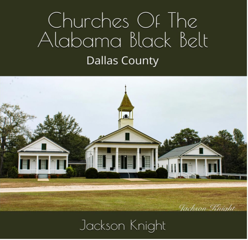
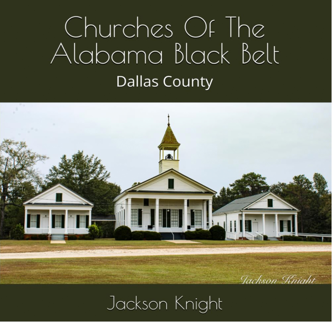
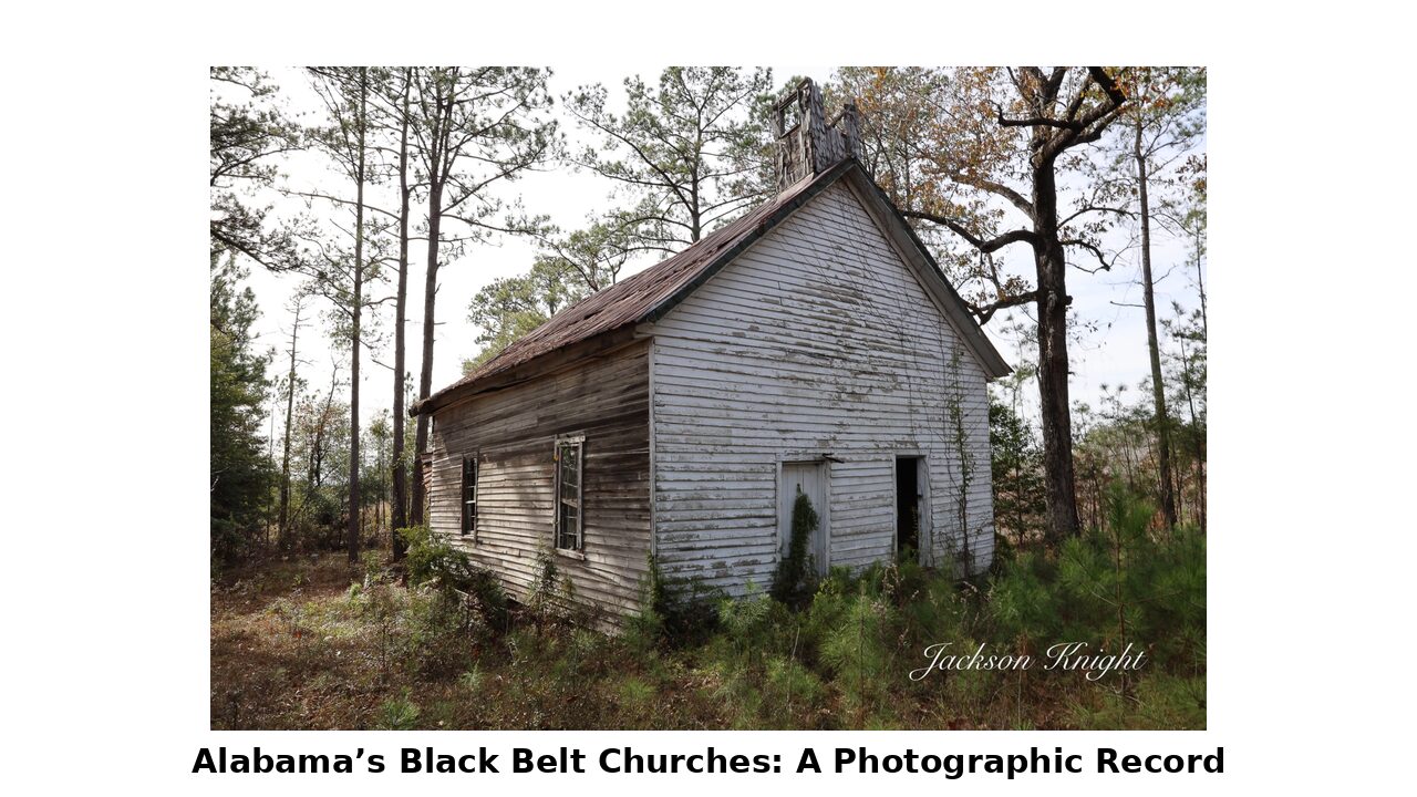
This volume in the Churches of the Alabama Black Belt series focuses on Dallas County, home to Selma and a wealth of historic churches that span urban centers and rural crossroads. With over 215 churches documented, this book includes recent photographs, locations, and visible cornerstone details when available — preserving a vital part of Alabama’s religious and architectural history.
This volume in the Churches of the Alabama Black Belt series focuses on Dallas County, home to Selma and a wealth of historic churches that span urban centers and rural crossroads. With over 215 churches documented, this book includes recent photographs, locations, and visible cornerstone details when available — preserving a vital part of Alabama’s religious and architectural history.
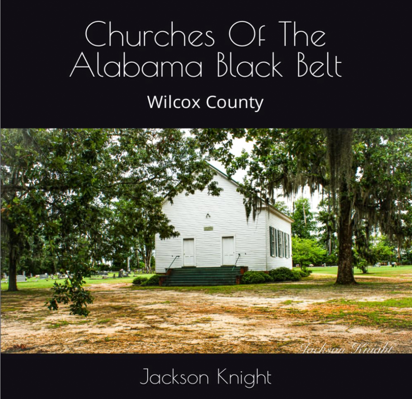
This volume in the Churches of the Alabama Black Belt series features Wilcox County, one of the most historically rich and architecturally distinct counties in the region. The book includes photographs and precise locations for more than 145 churches, from still-active congregations to abandoned rural sanctuaries. Each entry offers a visual and geographic record, with cornerstone dates and sign details noted where available.
Churches of the Alabama Black Belt: Wilcox County Now available on Amazon!
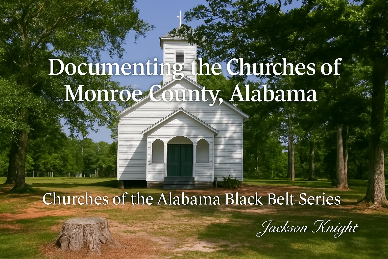
Some of the most striking church buildings in Alabama’s Black Belt sit quietly in Monroe County — some still active, others long abandoned, nearly forgotten. Over the past few years, I’ve photographed dozens of these churches to help document their presence before they’re lost to time, weather, or neglect.
My book, Churches of the Alabama Black Belt: Monroe County, features full-color photos of these sacred spaces, along with names, architectural features, and any visible signage or cornerstone details. These are places where generations worshiped — often with little fanfare and no recorded history.
For the past several years, I’ve been traveling across Alabama’s Black Belt, photographing and documenting its churches—some active, many abandoned, all with stories to tell. What began as a personal project has grown into a vast undertaking: more than 1,400 churches documented so far across 10 counties, each with a recent photograph and precise geographic coordinates. When available, I include founding dates, signage information, and cornerstone inscriptions.
This has been a labor of love. Every photo, every mile, every entry on my website has been done on my own time and my own dime. I’ve never asked for help—until now.
The truth is, this work comes with real costs: fuel, vehicle upkeep, equipment, internet access in the field, and the basic resources that make this possible. That’s why I’ve created a GoFundMe campaign.
👉 Click below to view and support the GoFundMe campaign:
Your support will go directly toward: – Fuel and travel costs – Photography and computer equipment and replacement – Satellite internet access – Vehicle maintenance – Other expenses directly related to continuing and expanding this project
Why This Matters
Many of these churches are disappearing—literally. One that I photographed not long ago was recently destroyed by vandals. It will never be documented again. Without this work, its memory would be gone. That’s why I believe this matters. And if you believe it does too, any amount of help is deeply appreciated.
Even if you’re not in a position to contribute, just sharing the campaign with others can go a long way.
Thank you for following along on this journey. If you’d like to explore the project further, you can always visit:
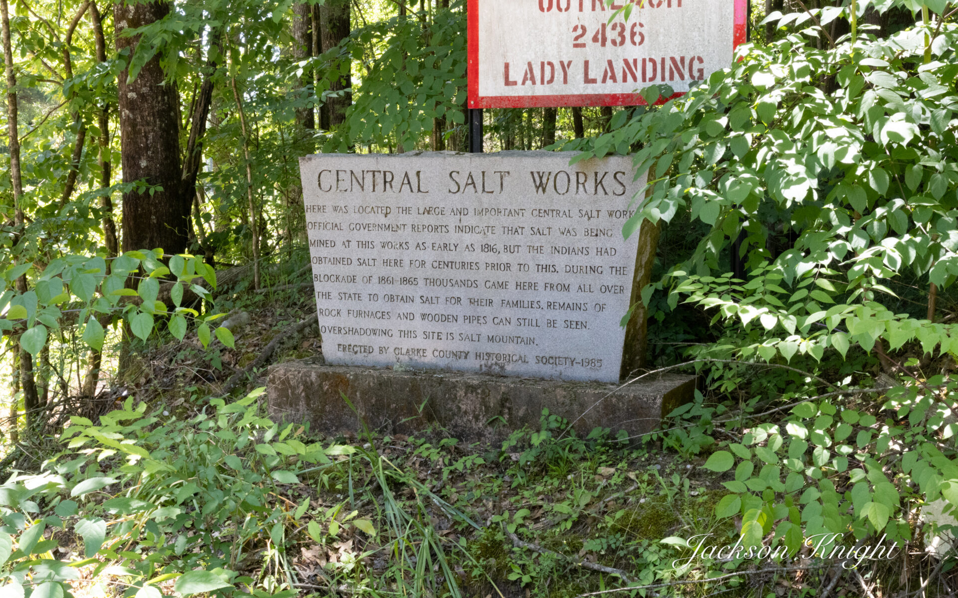
Rambling through the countryside always fascinates me. I say it every time I go on a rambling expedition. We are working on Clarke County currently and like so many other places it is a fascinating place to visit. One thing I have found in Clarke County is the number of granite historical markers that are located there. We recently came upon this neat marker near the community of Rockville. It marks the site of one of the South’s most critical wartime resources: the Central Salt Works. This historic…
Salt was an indispensable resource in the 19th century, primarily used for preserving meat before the advent of refrigeration. At the outbreak of the Civil War, much of the South’s salt had been imported from abroad—especially from England. However, the Union naval blockade, which began in 1861, effectively cut off these external supplies. This left the Confederacy scrambling to secure domestic sources of salt, as it became vital for both food preservation and other military uses (Jones, 2013, p. 114).
Clarke County, blessed with natural salt springs, quickly became a hub for Confederate salt production. Three major works sprang up: the Upper, Central, and Lower Salt Works. Among these, the Central Salt Works, located approximately six miles south of Jackson on Salt Creek, became particularly significant. Here, brine was drawn from subterranean springs and boiled in massive iron kettles set over fireboxes, a labor-intensive process that could produce over 600 bushels of salt daily at the operation’s peak (Alabama Historical Association, 1985).
The scale of the operation demanded a substantial labor force and logistical network. To defend the works against Union raids, Confederate forces constructed Fort Stonewall and Fort Sidney Johnston on the Alabama and Tombigbee Rivers. These fortifications were part of a broader strategy to safeguard critical inland resources and maintain supply lines to the Confederate armies (Brewer, 1872, p. 295).
Despite these efforts, the salt works were under constant threat. Union raiding parties frequently targeted salt production facilities throughout the South, understanding their vital role in Confederate logistics. While some sites were eventually destroyed, Clarke County’s salt works remained in production well into the latter part of the war.
Today, the Central Salt Works site is commemorated by the pictured historical marker installed by the Alabama Historical Association in 1985. It is located on the west side of County Road 15 near Christian Vall Road, the marker offers a brief yet memorable reminder of the site’s importance. It reads in part: “During the Civil War, Central Salt Works helped supply vital salt to the Confederacy… producing more than 600 bushels daily.”
For those interested in Alabama’s Civil War history or the industrial efforts that supported the Confederacy, the Central Salt Works stands as a testament to the resourcefulness and determination of a people under siege.
References
Alabama Historical Association. Central Salt Works Historical Marker. Installed 1985. Located near Rockville, Clarke County, AL.
Brewer, W. (1872). Alabama: Her History, Resources, War Record, and Public Men from 1540 to 1872. Barrett & Brown.
Flynt, W. (2004). Alabama in the Twentieth Century. University of Alabama Press.
Jones, L. (2013). The Confederacy’s Struggle for Survival: Blockades and Resource Wars. University of Alabama Press.
For those that follow us on our adventures we have been working hard in Perry County. As most know Perry County like most of our beautiful Black Belt Counties is very rural. While we were there we photographed over 100 churches and drove over 500 miles doing it.
We had issues locating a place to park our motorhome for a home base to work from.
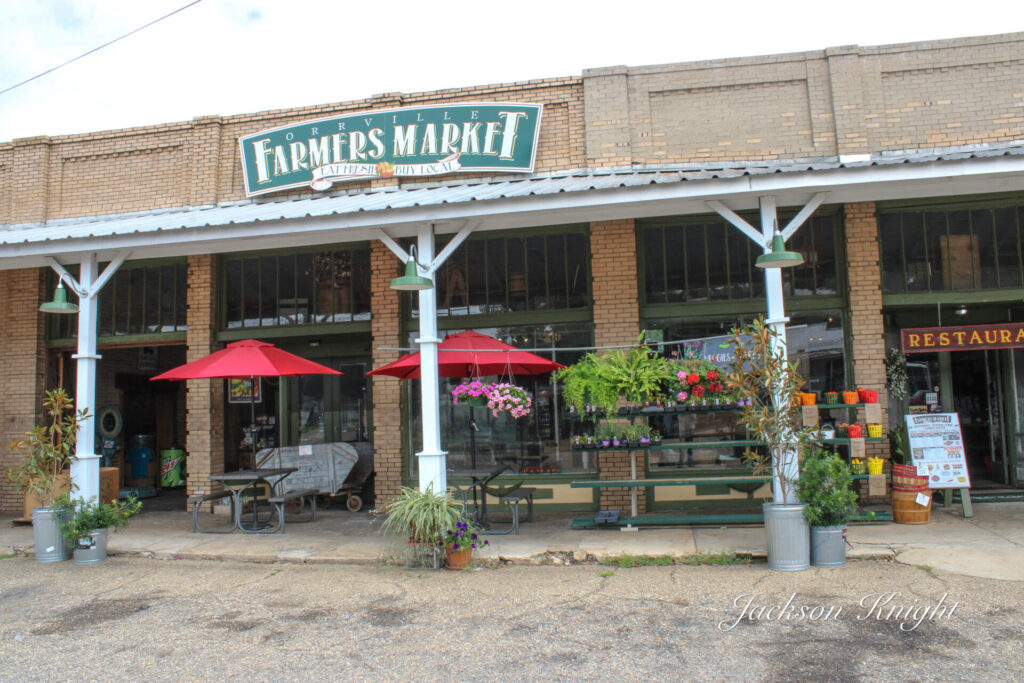
We met some nice folks while we were working in Dallas County that were gracious enough to sponsor us. They allowed us to park on their property where hunters have their trailers parked. It was definitely a blessing. We were only a few miles south of the Perry County line and it worked out great. As they were telling us about everything going on around us one thing that was mentioned was checking out the Farmer’s Market at Orville.
The Farmers Market is one of those places that I have passed numerous times on the way through on my ramblings. I have always said, “the next time I come through here I want to stop there”. It seems like I have always been in a hurry or had something else I needed to do.
Wednesday night we were talking about our trip home. I remembered the Orville Farmer’s Market and I told my wife that I wanted to stop by there and check it out on the way back through.
I had been following it on social media and knew that it had to be a neat place. I also knew that it was one of the hundreds of places in our beloved Black Belt that had always drawn me like a magnet draws iron but like I said earlier for some reason I had never stopped.
We got up Wednesday morning, packed things up in the motorhome. We then pulled out and went by and thanked our sponsors who had graciously helped us out. Then we hooked the Jeep to the motorhome and pulled out.
We arrived at Orville a few minutes early for lunch. We decided that we would just wait around till lunch was served.
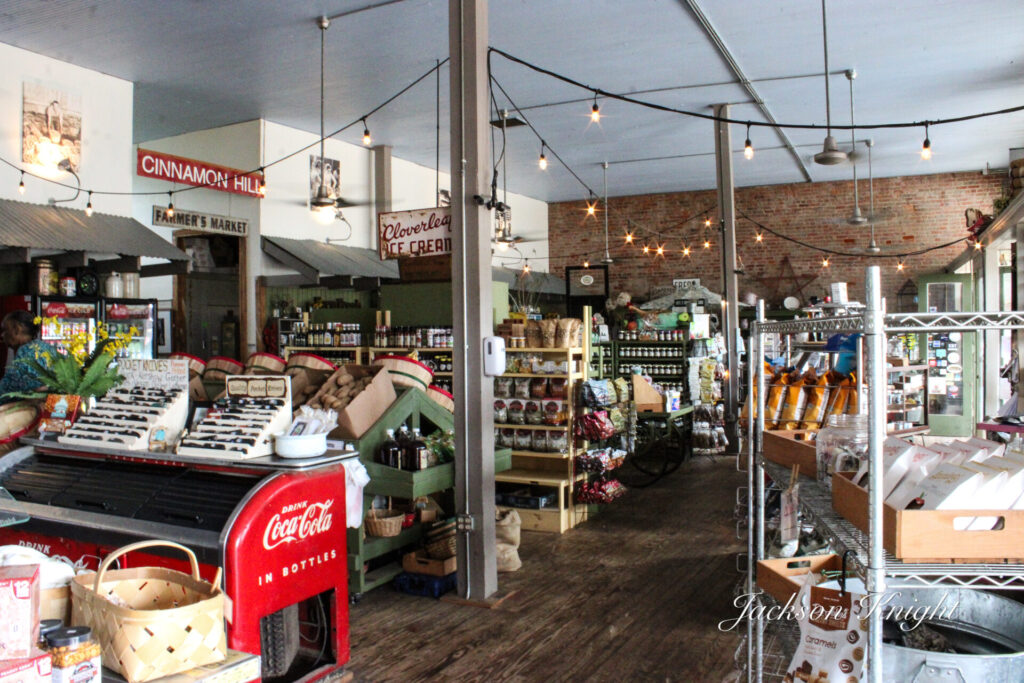
As we walked in the door, we were greeted by several young ladies that were at the counter. We strolled around looking at the well-stocked shelves of so many different things that I would not even start to try to name them.
I loved just walking around looking. There was so much to see, inside and out. Everything was so neat and clean. Whether it is garden supplies from seed or tools on they have it. Dry goods, canned goods, different apparel, gifts, there is something in there that will appeal to everybody.
There were many, many different things on the shelves. There were numerous different types of things like cheese of numerous varieties in the coolers. There were beautiful vegetables neatly arranged. We saw some jalapeno peppers that were huge. There were also some of the largest bell peppers I have ever seen. They would have made some incredible stuffed peppers.
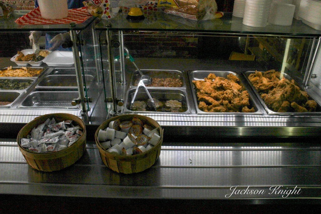
As we were finishing up our tour of the General Store, the workers were finishing up stocking the food on the buffet for lunch.
Then came decision time. I love lunch buffets, but I hate lunch buffets. I love them if they are good ones because I love good southern food. I hate them because it is too hard for me to decide what I want to eat. This one did not disappoint. It looked awesome from the get-go. I settled on chicken strips, okra, macaroni and cheese, and jalapeno cornbread, and sweet tea. Beverly had chicken strips, macaroni and cheese, collards, and jalapeno cornbread.
We got our food and settled at a table in the dining room. The food was awesome. I had NO complaints. The food was excellent. We had to take some of our food home because it was more than we could eat.
I have seen the shirts with the saying on them, American by birth, and Southern by the grace of God. In my humble opinion there are no truer words. We are a blessed people to have the opportunity to experience the wonders of our beloved Southland. In the heart of that is this special place called the Black Belt.
Our Black Belt houses many treasures. I would have to say that the Orville Farmer’s Market is one of those treasures that if you have not visited, you definitely need to. It is definitely worth the drive if you are anywhere close to the area. If you are traveling mark the spot and check it out. You won’t regret it. We will be back as we continue to ramble.
My wife and I have been married over 40 years. Rarely do you see one of us that you do not see us both. Neither of us can stand to just stay at the house. Not because being at home is bad. In fact, we sit at home a lot as well as ramble. Buuutttttt. If rambling is an option, then that is the option we are going to take.
Life is an adventure. I have found that there is always something new to experience. Somebody new to meet is always right around the corner. A new place to go, or a new place to eat is always there.
Last Summer I actually did do some traveling by myself. I went out 5 trips throughout Southeast Alabama. I ran several thousand miles visiting rural map dot towns. You know, the ones that are not on the interstate. The ones that sadly are now in a terrible situation. Those places that so many people relate to. Many times, they are remembered now as places we went to when our grandparents were still alive. For many more they are where we were raised. They represent a different place and a different time. For most of us it is good memories. For so many of us it is a place and time we miss so badly and would love to be back in.
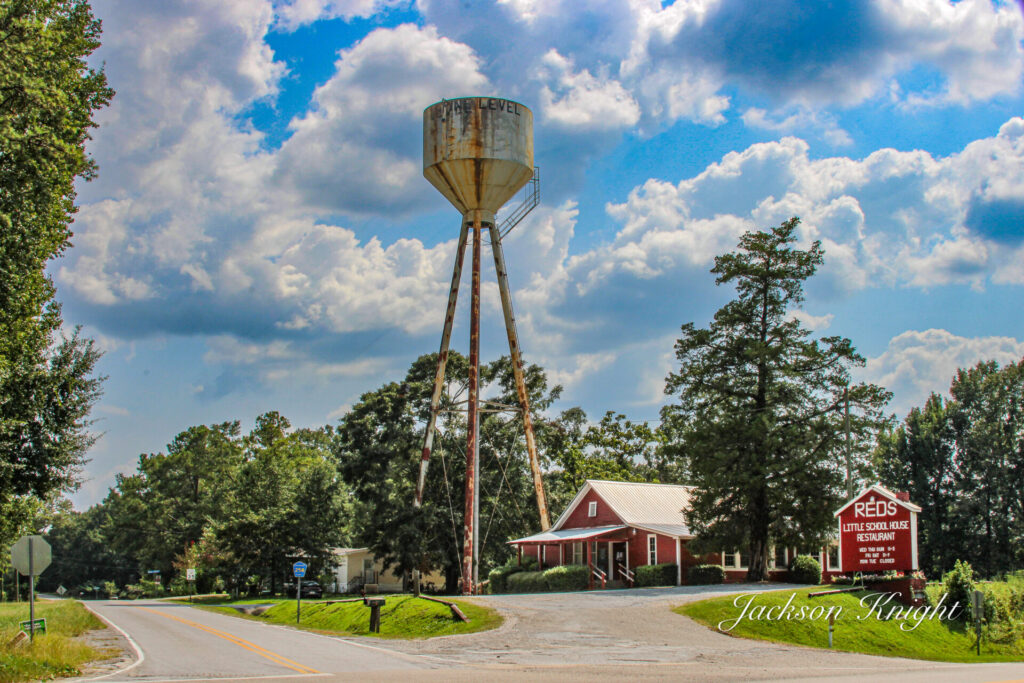
On one of my trips last year, I took a photo of a neat looking place over in the vicinity of Grady, Alabama. I honestly think I took it more for the fact that there was a neat sign with a water tower in the background. When I am out taking photos of that type I normally always capture a few shots of water towers.
I think the place was closed that particular day, or possibly it was the hour of the day that I was there. After I got home and shared photos and communicated with folks and so forth, I came across this business on Facebook.
The name of the business was Red’s Little School House. It is a restaurant. I have followed them on social media ever since. I have commented on their page more than once that when I was back working in that area that I was going to have lunch there.
A couple of weeks ago my wife and I were talking about some future excursions. The subject of Red’s Little School House came up. I commented that we had been in Lowndes County recently working and should have broken off one day and went up and given it a try. Unfortunately, we had been preoccupied and did not think about it. My wife said, “why don’t we just ride up there and give it a try?” With that said she got online and found out when it was open, and we made plans.
Now we have been to some incredible places, and we have been to some places that we are not going to go back to. We set out early to mid-morning of Wednesday June 6. We located it on the map and followed GPS. When we got there, I looked, and we had driven exactly 100 miles. That is a pretty good ride to eat lunch at a place you have never been to nor talked personally to that has eaten there before. I had told my wife on the way up more than one time, “I hope we are not disappointed.” Her response every time was, “we have been disappointed before, and I bet we have had worse.”
When we drove up there were cars in the parking lot, but we were kind of early, so it was not crowded. We walked in and were immediately greeted by a friendly young lady who told us to sit wherever we chose. When we got settled at a table she came and took our drink order. She then said help yourself to the buffet.
We headed out! Fried Chicken, chicken livers, pulled pork, camp stew, hamburger steak in gravy, vegetables, fried cornbread, and rolls. OH MY. I loaded my plate. I wanted to try as many different things as possible, but realized real quick that there was no way I could try it all.
We went to the table and all I can say was wow! There was a sign I read in there that said, “If you find food any better your grandmother cooked it”, or something very similar. That my friends, was an understatement! I have eaten folk’s grandmothers cooking that was not as good as that was. Actually I have had a lot of home cooking that was not as good as that.
The only thing I regret about that trip is that instead of just going through the line and helping my plate, I wish I had gone through and checked it out before. I LOVE fried chicken, and I love chicken livers. That fried chicken was excellent. The livers were as well. HOWEVER, WHEN and I said when not IF I go back if it is on a Wednesday and they have the hamburger steak I definitely will load up on that and if they have the camp-stew, I will load up on that. There was not one thing we tried that was not wonderful in our opinion.
So to recap this, we drove a hundred miles to a local restaurant that serves a lunch buffet for lunch. If you have never been there, we highly recommend you give it a try. We definitely will go back and eat there if we are anywhere close to the area. In fact, we are subject any time to get up one morning and make the drive back and give it another whirl.
My hat’s off to Red’s Little School House. Your food in my opinion is better than you portray it to be. I highly recommend you to anybody hunting great home cooked Southern Food.
On an almost daily basis I see people who are hunting something different. What I mean is they are fed up with the hustle and bustle of modern life. They are fed up with everything associated with the industries today that are governed by money rather than efficiency. Many are learning to be self-sufficient.
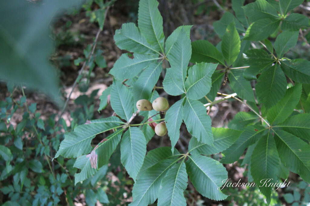
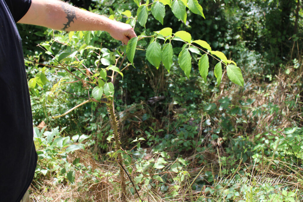
Buck eye
I see many that are growing their own food and learning the old ways of doing things that worked for centuries. I like so many I encounter are interested in many of these old and mostly lost ideas. One of the things that I personally am interested in is natural medications. I am at this writing 67 years old and I do not take any medication of any kind nor does my wife. We are thankful for this and hope it remains that way as long as we live. We also hope to live long productive lives.
I have on more than one occasion seen books offered that taught about utilizing wild plants to eat and medicate. For me anyway it would get overwhelming. First off it utilized plants from all over the world or at least not my local area.
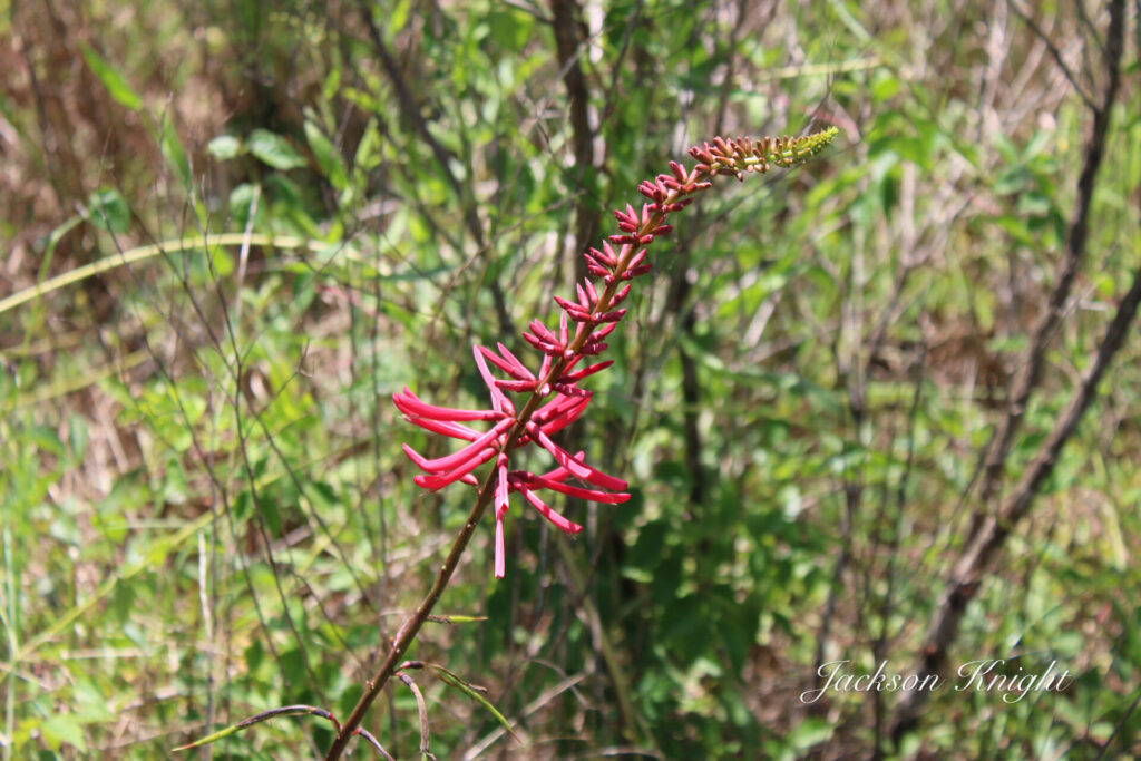
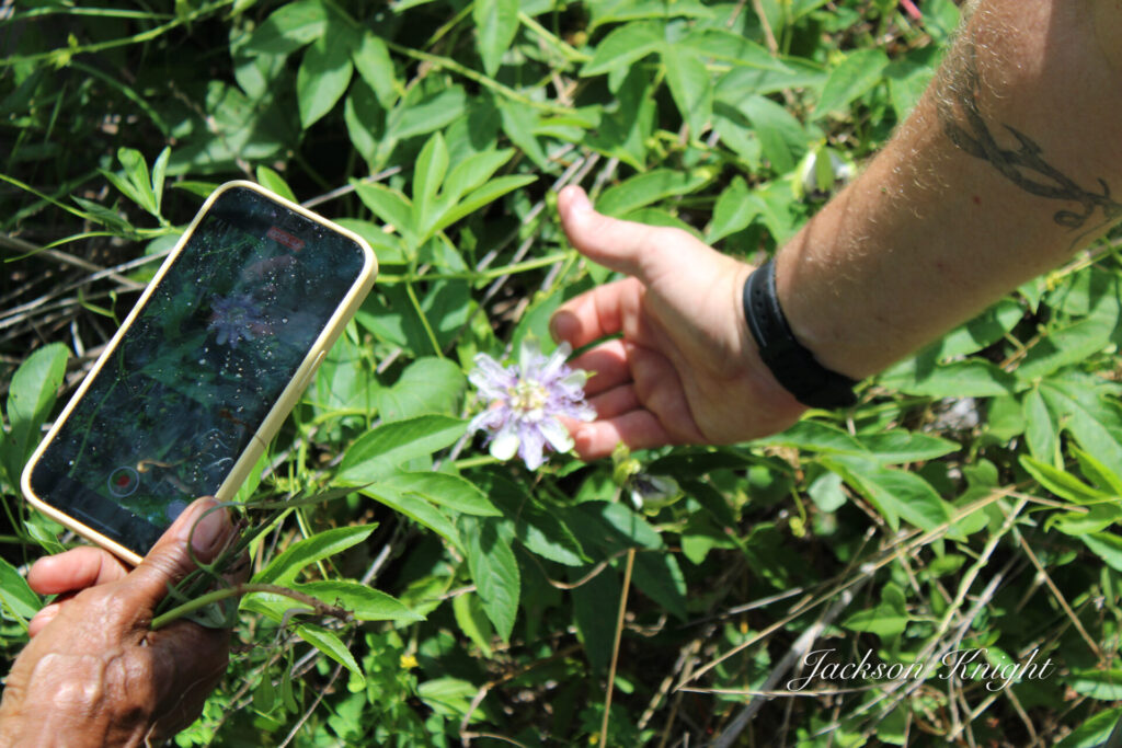
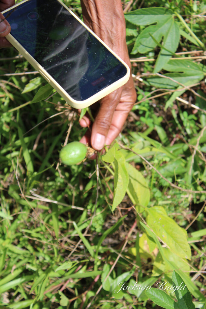
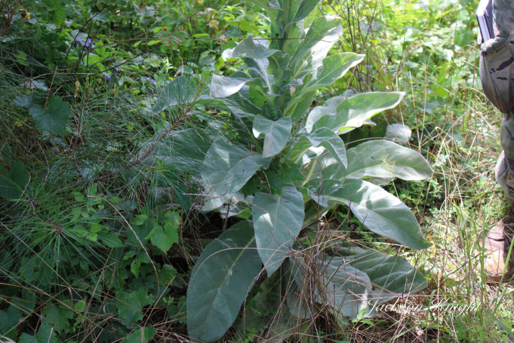
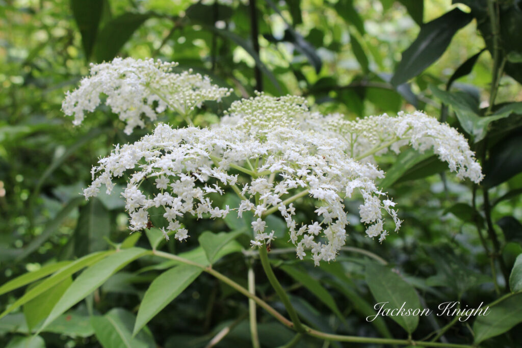
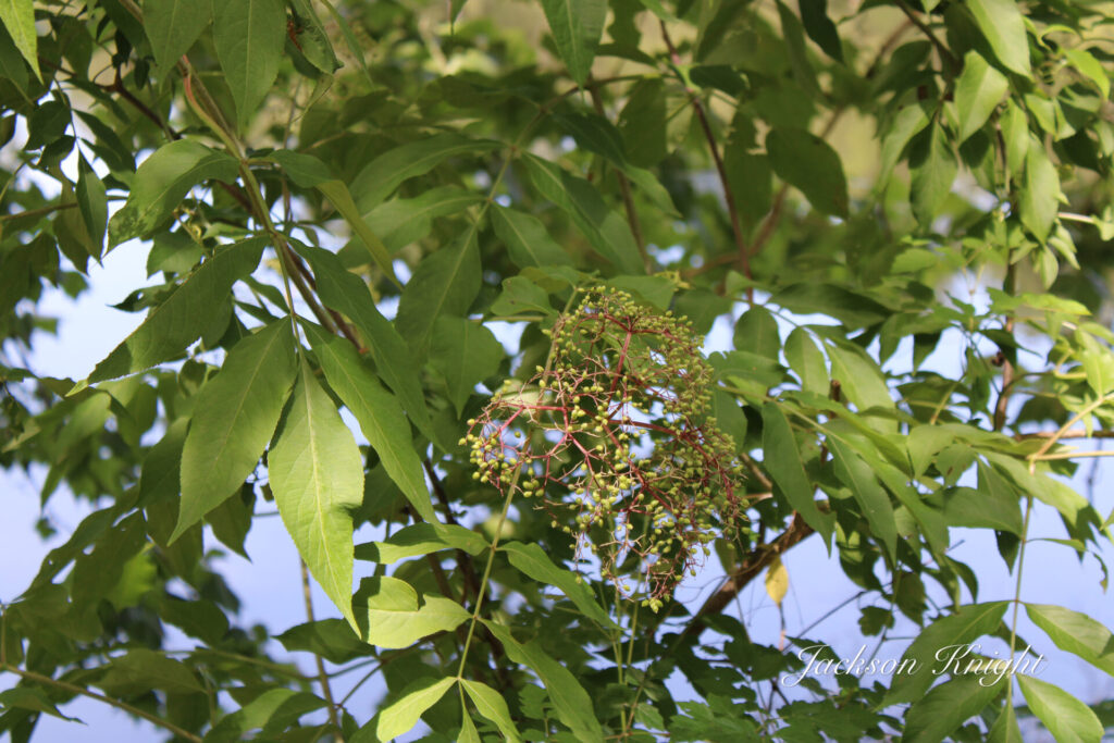
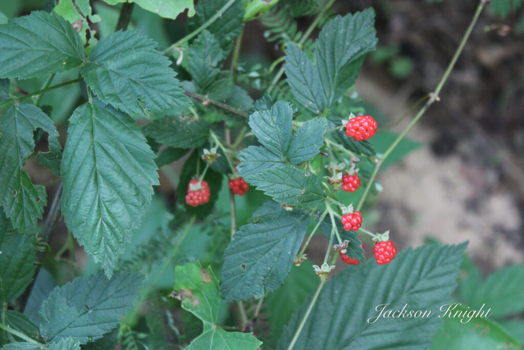
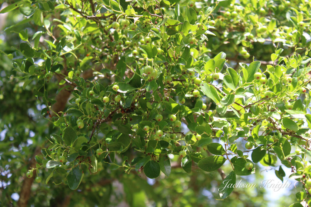
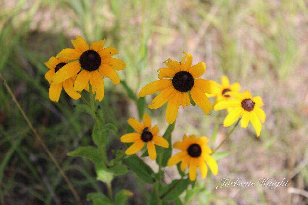
Highly toxic in bloodstream.Passion Fruit, “May Pop”.MulleinElderberry plantBlack BerryDevil’s Walking StickHuckleberryBrown Eyed Susan
Recently I have started noticing people on social media talking about plant walks. My curiosity was spurred. Exactly what is a plant walk, and what happens at one? Those were two questions I wanted to find out the answer to.
A few weeks ago my friend Demp Bell messaged me and asked me to come to one. He owns Cornwallis 1828 which is a very interesting and unique place in the Alabama Black Belt. I serve as one of the Pro Staff Photographers for Cornwallis 1828.
I was eager to get this on my calendar. It was a Saturday morning event. I made the drive up and was waiting when others started to arrive. I was introduced to a young man named Kyle Fuqua. He was the guy who was leading the plant walk. It did not take two minutes to realize he was a walking encyclopedia on plants. I was both shocked and amazed at his knowledge.
Within a few minutes others started to arrive. Demp had coffee, muffins, juice, milk and other things on hand for those attending. As always everything I have ever participated in at Cornwallis 1828 was done with perfection.
As we started one of the first things I learned was that in the short distance we were going to walk Kyle had scouted the evening before. He said he had identified over 80 plants within a short distance of the trails he had covered. I would estimate the distance to be ½ mile approximately.
Once we got started it was incredible to follow along and learn. Over the course of the next three hours, we learned that you can make cookies or bread from persimmons that grow wild. We learned that you could utilize the leaves and balls from a Sweetgum Tree to create the equivalent of Tamiflu to treat cold or flu.
We learned that Ragweed is very nutritious and that although most people think they are allergic to Golden Rod but, it is Ragweed that causes the allergy. Ragweed is at the right stage at the same time as the Goldenrod blooms. That is why folks blame the Goldenrod for their allergies.
We learned that you could put white clover in soups and stews. The numbers of other plants that we learned you can eat is just unreal. I have spent countless hours in the woods in my lifetime and I had no clue that many were nutritious and edible.
We found out that what we commonly call Begger lice can be utilized as an antibiotic. Curley dock roots can be used as an anti-parasitic.
Kudzu, of all things, astounded me. You can eat the leaves; you can take the roots and make flour. Kudzu flowers are edible and can be used to make jelly.
It just goes on and on and on as to what works for what. Another thing we learned was that many times moss will have chiggers in it so stay away from it.
Beauty Berry can be used as a natural mosquito repellant, as well as other things. Saw briar leaves can be used to make a tea that is good for the common cold. Dog Fennel can be used on the skin for bug bites but will shut your liver down if you ingest it.
It is intriguing, literally that there are so many things right there around you that you walk and drive past daily that can serve so many purposes in everyday life. Many can be eaten. Many can be used as medications. Many are poisonous. Many that are poisonous can be used if they are prepared correctly.
Discussion was made before we all left as to the possibility of doing future plant walks. I highly recommend to anyone that is remotely interested to find Cornwallis 1828 on social media and watch for upcoming events of that type. I truly believe that pretty much anyone would benefit from the knowledge that is passed on through these events.
Cornwallis 1828 is a special place in the Black Belt Region of Alabama. It is a place of learning and history. Children can roam free and be safe. I know I plan to be at the next plant walk that is held and I cordially invite you too as well.
I have been told all my life that seldom does one have more than one perfect dog in his life. I can’t honestly say that is true because in my lifetime I have owned several. All of which were a different breed and served a different purpose at a different stage of my life.
When the boys were growing up, I had a couple of decent bird dogs but none that I would say were outstanding by any sense of the word.
We started rabbit hunting with beagles and over the years we ran them I culled many to get some really good ones. I had a 15” Tri-color that I would have dropped the tail gate on with any that I ever saw run. His name was Barney and he would tote the mail for you.
He was a big-mouthed dog that I could literally pick out of a hundred running in a big pack competition. I have seen him run briar patches until he would be bloody like he had been in a fight. I have seen him run till he would be so sore that he could hardly climb out of the doghouse the next morning. He did not know the meaning of the word quit. I ran him with a female we called Lucy, and she could hold her own as well with about anything that you dropped out with her.
Over the years I had a couple of working herd dogs that were fair as well.
We had gone years without a dog while we were involved in ministry. I did not have any livestock and did not hunt.
I decided in 2013 that I wanted a dog as a companion animal. I got a puppy that was brindle colored and called him Peete. He was very intelligent, but he just did not fit with our lifestyle. I learned quickly that I needed a dog had a lot of criteria that had to be met or I could not make it work for us or the dog.
I found a home for Peete, and we decided that we would try to adopt one from the animal shelter. We went to the shelter the last week in May of 2013. We found a small female dog that for some reason we were attracted to. Honest to goodness it was almost like trying to adopt a child from a foreign country. I came within an inch of walking away and telling the lady at the shelter to forget it. We had to fill out an application and the lady grilled us on numerous questions. The lady told us to come back the following Monday and if we were accepted that we could pick up our dog. Again, I almost did not go back. It was ridiculous.
We went back though the first Monday in June of 2013. We picked our little dog up and carried her to a groomer and had her bathed and trimmed and she looked like a different little dog. The girls in the shelter had named her Taffy and we chose not to change her name.
The lady who groomed her asked us was she about to have puppies. We had been told at the shelter that she was not with puppies. We took her to the vet to have her health checked. The vet said that she was not with puppies that he could tell. A few days later we left her with our granddaughter for a day while we were out of town and while we were gone, she delivered two puppies.
We took care of her and the puppies till the puppies were old enough to wean and we gave them away to a friend. We had Taffy spayed and life was good.
Taffy was exactly what I had been hunting. If you heard her bark or alert, you had better get up and check. Somebody or something was there. She was NOT a yapper. House broke to the utmost. Playful enough to be fun but not overboard. Never met a stranger.
She was attached to all of our family members that visited. Most Friday evenings family would come to our house, and we all ate together. One of our brother in laws named Bob always played with Taffy. When Friday came Taffy would gather her toys and be playing with them by 3 in the afternoon. We could ask her “Taffy, is Uncle Bob out there?” Immediately she would run to the door and look. If she was in the sun-room she would rear up to look out the window.
There were numerous other things we could ask her and get a response. She would immediately hunt me or Beverly if the other one asked her where we were.
We were never sure exactly what Taffy was. She was a beautiful blonde color. She did not shed at all. NO hair in the house period. We thought from her appearance that she was a cross between a Dachshund and a Yorkie. My wife took her photo one time with the Google Lens on her phone and it said she was a cross with a Dachshund and a Poodle. We never went to the time nor expense to have her DNA tested to see what she was.
Taffy weighted 15 pounds and pretty much always held within a pound or so of that.
I have seen many little dogs in my life, but I honestly can say I have never dealt with a dog that had more intelligence than Taffy. You could literally talk to Taffy like she was a kid and she would mind.
If I was sitting in my recliner, she was going to be laying between me and the left arm of the recliner. If my wife was sitting on the couch, she would sit with her a while and then come sit with me. She had rather ride in the jeep than eat when she was hungry. She could jump up in my Jeep which was sitting in 35” mud-grips with NO trouble if she knew she was going to get to ride.
In 2022 we noticed Taffy was losing weight. We had her checked and the vet did not find anything wrong with her. We spent 8 days with family out of state over Christmas of 2022 and boarded Taffy. That was the longest she had been away from us in all of those years. When we got back we noticed changes in her. Normally over all the years we could just leave food out for her. She would just graze through and pick up a few morsels of dry food and bring it in the living room and eat it a few times a day. After that time, she would eat everything we put out immediately. Soon she started having anxiety attacks. If we left, her alone for any length of time she would have anxiety issues. Sometimes she would have them even sitting at home with us at night.
Honestly looking back, she had been going downhill long before that. Us being away from her for that long we saw it magnified. Kind of like when I worked shutdowns and did not see my kids for long periods of time and then saw them and realized they had grown.
In December of 2023 we noticed she was fading fast. Her belly was getting enlarged and she had no energy. She would not play with her toys and just was not herself. Our vet examined her and did an x-ray. That is when we realized that her liver and some other organs were severly enlarged. She also had a bladder infection that would not go away. We had to keep her on antibiotics constantly and as soon as we stopped them it was back with a vengeance. We knew then that it was a matter of time.
Over the next weeks we saw her fade fast. She got to the point that it was a labor for her to just get up the two steps into the house. She would have to go out numerous times a day which she had never had to do. One afternoon when she went outside she fell over and it was hard for her to just get up.
Our forty first anniversary was Feb 4. That day we realized we were going to be faced with what we had been dreading for a long time. She had gotten to the point that she was drinking unreal amounts of water. It was obvious she was suffering, and she could not control her bladder which was not normal.
The next day Feb. 5, we were eating lunch and both of us knew it was time. We called the vet and made an appointment. We then took her and wrapped her up and took her out and rode on the golf cart. That was one of the joys of her little life. She just laid in Beverly’s lap and looked. We knew we were making the right decision as hard as it was to do it. We took her in. They took us into the back and the vets assistant told me that she needed to hold her to assist the vet.
We stood there with her rubbing her till she was gone. In my opinion we were the most important thing in her life and we stayed with her till she was gone. Then we brought her home and buried her.
Our constant companion was gone.
Forever it seemed everywhere we went was a reminder of Taffy. There was a water bowl in the car, and in the Jeep, and in the pickup. There were toys here there and yonder. Her food, and water bowls in the house and in the camper. There were the little smudges on the car and Jeep windows where she had put her nose looking out the windows. The same little smudges on the windows at the house where she had always ran to check things out if she heard something outside to investigate.
Even now months later we still come across stuff that as associated with Taffy.
We have no intentions of getting another dog. We discussed it but first off, there will never be another one as perfect for us as she was. Plus, because we are always on the go it would be hard to take on the responsibility.
I honestly don’t believe that once you have had that perfect one there is nothing better. Little Taffy was one of a kind. If there was ever a perfect little companion doggie. Taffy was it.
So many times, in life we know so much about so many things, only to wonder what we really do not know about them. I hope that made sense.
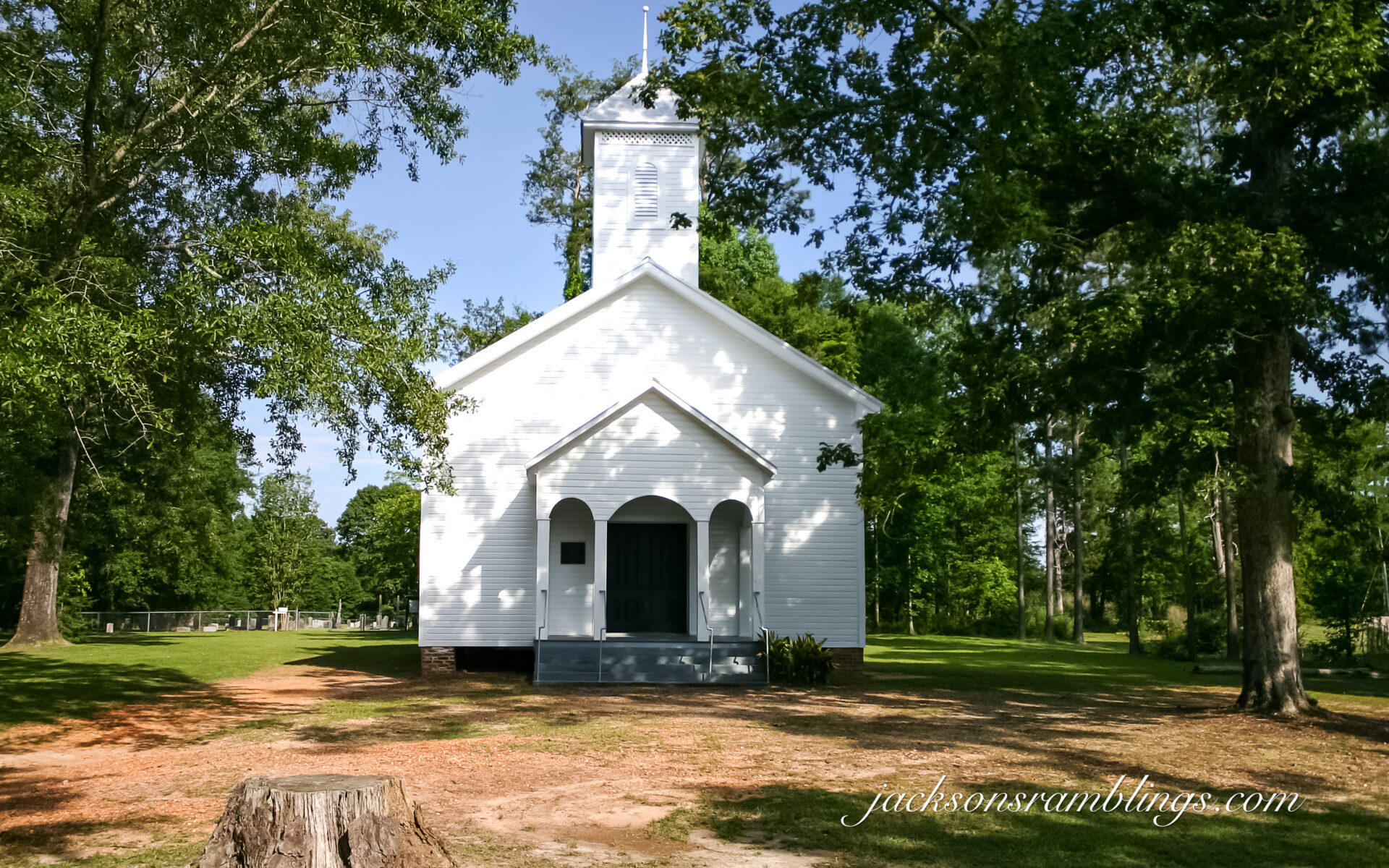
For me, I have known of The Bell’s Landing Presbyterian Church all my life. The earliest picture of me that I know of being made was taken supposedly at a wedding at that church. I was a very tiny kid. That would have been in 1957. As a preschooler I stayed with my great aunt who lived right up the lane from it. On a regular basis she would take me out for a walk, and we would walk up to that church. She would always go in and check things out and make sure that everything was ok. I would many times stay out and play on the steps while she was inside. Sometimes I think she would be cleaning up some. Other times I think she was quite possibly be praying. Not totally sure. I was very small. Needless to say, though my earliest memories as a small child contain that old church.
Although I have not been inside of it now in probably close to 60 or so years. As a kid, I went inside of it many times with my auntie when she was making her rounds checking things out.
I do not know the year, but I remember my father and some more men doing something on the top of it. I remember that my dad and Mr. Paul Miles were on top. I remember they had a rope that they were using to pull things up to work with. I remember us walking up to where they were working and putting things in a bucket that they pulled up.
I always knew about it, but recently I started to wonder what the history of it was that I did not know.
Recently I was doing research on some things. I came across a site that had a page titled The McCants Notes. Knowing that the McCants family was a prominent family of the time in that area it jumped out at me so to speak.
These notes start out speaking of two brothers who came to Southern Wilcox County. Their names were John and Thomas McCants. John had a son about 4 years old named Thomas as well. It states that in or “before” 1816 a house was made from hewn logs for a church. This building was used until about 1819.
Apparently in 1819 or there about a dispute started concerning the land on which the log church was located. The land was originally settled by Thomas McCants Sr. Apparently it was not properly recorded. A neighbor by the name of Peter McArthur showed government documents for the property and that brought on the dispute.
At this point in the notes is stated that “tradition states” that there was a “church session”. I interpret that to mean a church meeting. Supposedly this meeting was to determine the ownership of the land. The outcome of the meeting determined that Mr. McArthur proved his title to it and therefore secured his claim.
Then we see that this angered Thomas McCants so badly that he withdrew his alliance to the Presbyterian church and joined the Methodist Church.
The notes say that at that time the log building was torn down and moved across the road to the site of the present Preston Place. It then was used for a few years as a church and then converted into The McCants Inn.
I personally am not sure about that location. I know from being with my great aunt and my grandparents so much as a child that all of the last names were familiar to me. I understand that my great grandparents had moved to this area I am thinking in the 1920’s or 30’s. I am not certain where that would be though. Possibly towards the Vredenburgh area but I am not sure.
Also, this was the first I had ever heard or read of a McCants Inn being in that part of the world.
There is an article in the Spring/Summer edition of Legacy Magazine of the Monroe County Heritage Museum that tells almost word for word the same story up to this point. It does not mention the McCants Inn.
The Legacy magazine states that The Presbyterian Church moved about three miles from its original site and about five miles from the present site. That source goes on to state that they then moved to Magnolia Academy, where they held worship services until they built a building on the present site in 1885.
Again, I do not remember ever hearing of a Magnolia Academy. I am not sure at the time of this writing where it was located but will definitely be looking for that name in anything I find document wise in the future.
Switching back to the McCants notes again I see stated that they moved to a site that is designated as the present site of the Pine Flat Baptist Church. It states that there was a Union church located there that had a slave gallery. It goes on to state that they worshiped there until the 1850’s and from there it went to Magnolia Academy.
Both accounts put the church locating at the present site in 1885. Both writings also state that that building was destroyed by a storm on May 10, 1927.
According to the McCants notes the present building was not yet dedicated at the writing of that document Feb. 12, 1932.
My family lived in that area by the 1930’s. My grandparents lived approximately ¾ of a mile as the crow flies from the Presbyterian Church. My Great Grand Parents lived on the land beside the church.
Another name I saw mentioned in those notes was a Samuel Grace. My grandparents said they got the land they lived on from Mr. Sam Grace.
For me to learn this much about this old church was an awesome experience. I had known all my life but then there was so much that I did not know. There is definitely a long rich history of that area and the community located there. As always, I am only more excited to learn more. Thank God for those that saw fit to write notes of all of this over the years so that we can find tidbits like these to go forward learning more.
Sources: (1) The McCants Letters, https://robertstapleton.tripod.com/mccantsletters.html
Several people have asked me the question, “Why the Black Belt”?
Here is the best explanation I can give. Ever since I got back into photography a few years ago I have been sort of searching for a niche. I love drones, history, the outdoors, and writing stories.
I have retired from both my lawn service business and as the pastor of a small church. My wife and I love to get out and ramble. Our health is good. Normally when I am out and about she is with me.
I have been for quite a while shooting drone photos and videos of forest fire lookout towers. I bought my first digital SLR camera a couple of years ago. I had of course always since I was a kid loved photography. In the 1980’s and 90’s before digital I shot a lot of 35mm photos. I had owned numerous cheap digital cameras and taken a lot of photos with them also.
I felt the need/desire or whatever you would term it to travel and document the various things of our beloved southland. Even back with 35mm I did that often as well as some wildlife photography. First off, I started doing drone videos and putting them on YouTube. As that progressed, I started shooting photos of other things. I especially liked documenting pre-1900 churches.
I had already traveled over several counties in Alabama and some in Mississippi taking photos of the small towns. Midsummer of 2023, I started to try to visit all 67 counties in Alabama. I actually wrote a blog post on doing that in August. Rambling The Black Belt.
I decided to work the area East of I-65 from the bottom of the state to the top. Then, I would work the area from the bottom to the top on the West side of I-65. I went out four times. I would leave home, hit as many small map-dot towns as I could in a day. Then I would spend the night in my van and go again the next day.
I did this four different times. Three of those times I ran almost 600 miles each and put in a lot of hours. The fourth I ran over 700 miles. I would take so many photos doing this, that it would take me two weeks several hours a day, after I got home, to just go through, sort and locate where all the photos were taken. After that even more time to process and share to social media and on the website.
I was thoroughly enjoying doing what I was doing and planned to continue till I got all 67 counties. When I got up as far north as Hwy. US-80 which had me working the Eastern Black Belt I started to realize that I was trying to cover too much territory at the time. I was taking hundreds of photos, but I was trying to cover too much too thinly. Doing it this way just did not give me enough time to find out anything about what I was photographing. I was just getting photos but not getting the story behind the photos.
That is when I realized that I needed to focus deeper on one area and stick with it. Because there is so much of what I love in the Black Belt, that was where I needed to be. So here I am.
My goal now is to focus for as long as it takes on primarily the Western, Alabama, Black Belt. Western, meaning the areas primarily West of I-65. I do plan at some point to go back into the Eastern part again and do it the same way. My plan is to capture photos of as many of the pre-1900 churches as I can locate as well as any other things of historical interest. Along the way I will document whatever else that I run across that is interesting, unusual, or basically that catches my attention. I will focus at times on wildlife and primarily birds. The Black Belt is very rich in birds, and I feel that is something else I would like to keep documenting.
As I document the churches, I post them on my website under the tab Black Belt Churches. That page has an index of the counties. Under the tabs of the counties are the links to the individual pages of the churches themselves listed in alphabetical order for that county. That will be an ongoing work where I populate the various county pages as I visit them. Over time it will be into the hundreds of historical churches.
I have been and will continue to write blog posts on whatever and whenever as I travel. They can be viewed as I post them on my web site jacksonsramblings.com. I would like to go back to making some videos but I will not say when that will happen because doing what I am trying to accomplish now is a full time job, believe it or not.
From the information gathered and shared on my website it would be nice to have some books as well as calendars and other material printed.
I have always loved wildlife and at some point, I would like to have my wildlife photos somewhere as well, possibly another page on the website or on another website.
This is a project that to do it justice will take several years quite possibly. A lot of it will take multiple trips into the same area over the coming months and even years.
It would be incredible if I could pick up some sponsors who would love to see this accomplished. I could really use some updates on some of my camera equipment. There is also a considerable cost involved in traveling, maintaining and at some point, replacing my Jeep. There are also expenses to maintain my small motorhome, as well as fuel and campground fees, meals when traveling, and so forth. There are always computer related expenses as well. My current MacBook is three years old so hopefully I won’t have to replace it for a good while yet.
Between my Facebook groups and pages, I now have in the thousands that follow and I appreciate the friendships that I have already made and look forward to a whole lot more as time goes on. I can only imagine what the coming months and years can and will bring. There are so many that I want to meet face to face and learn their stories and the stories of their family’s contributions to our great Black Belt Reigon.
If you have read this far, I welcome you and hope you will see fit to follow along on this project as I travel our beloved Historical Alabama Black Belt.
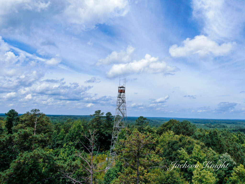
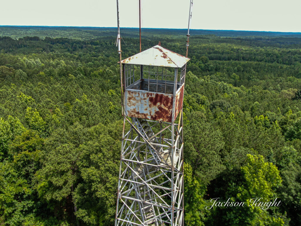
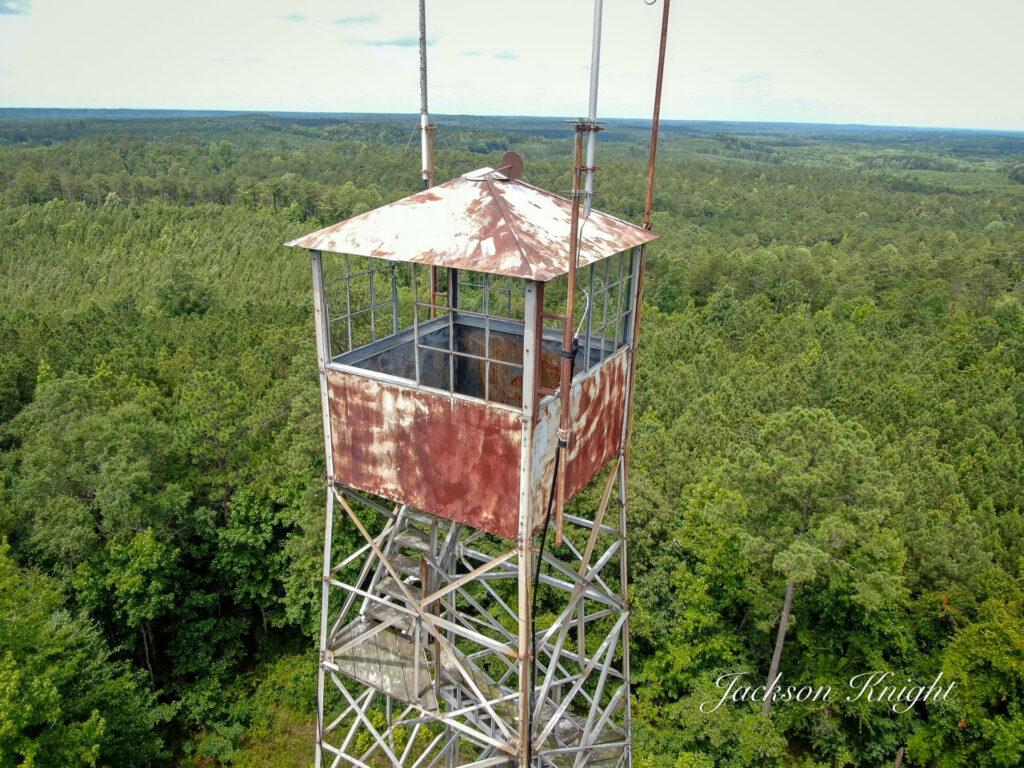
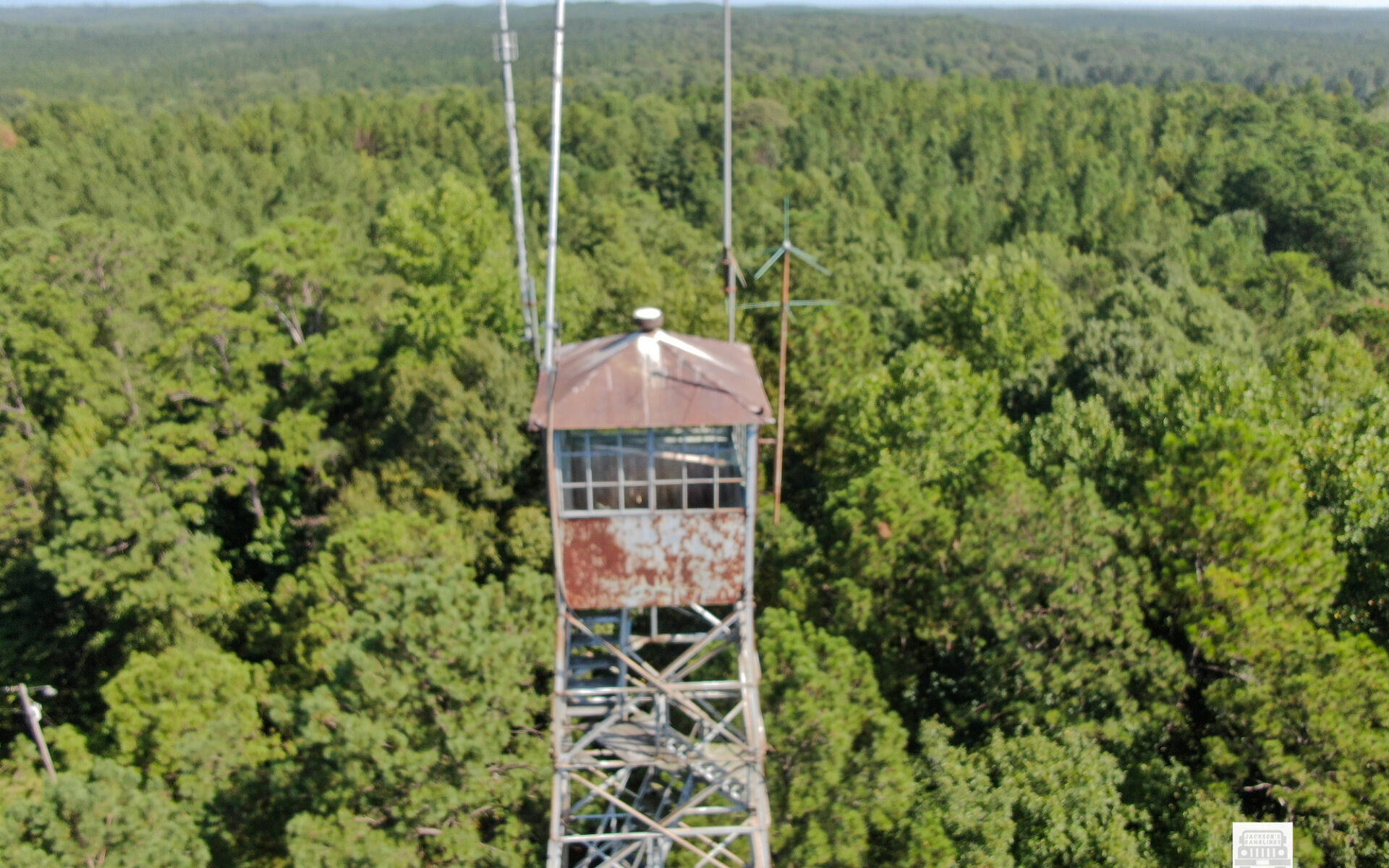
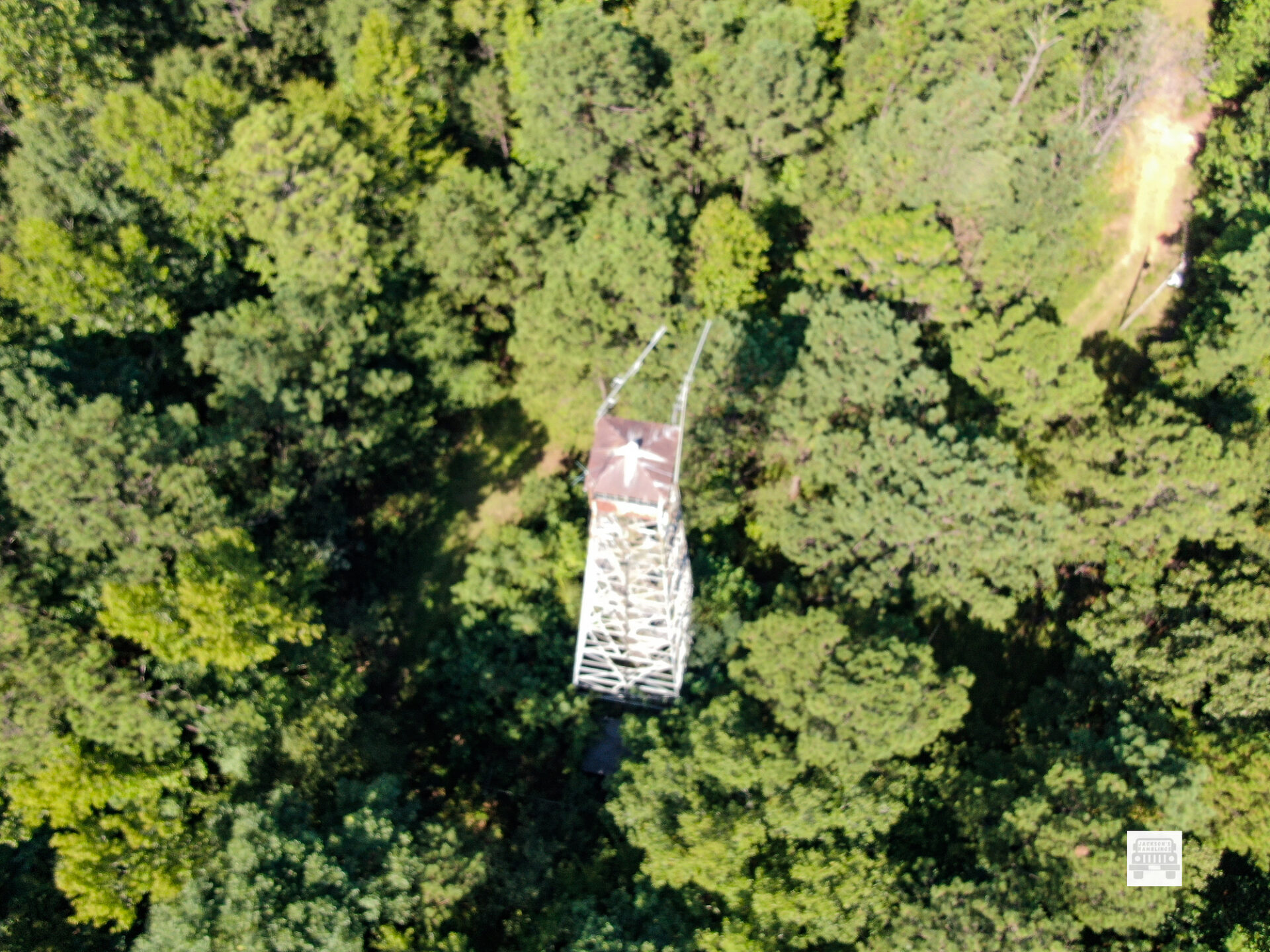
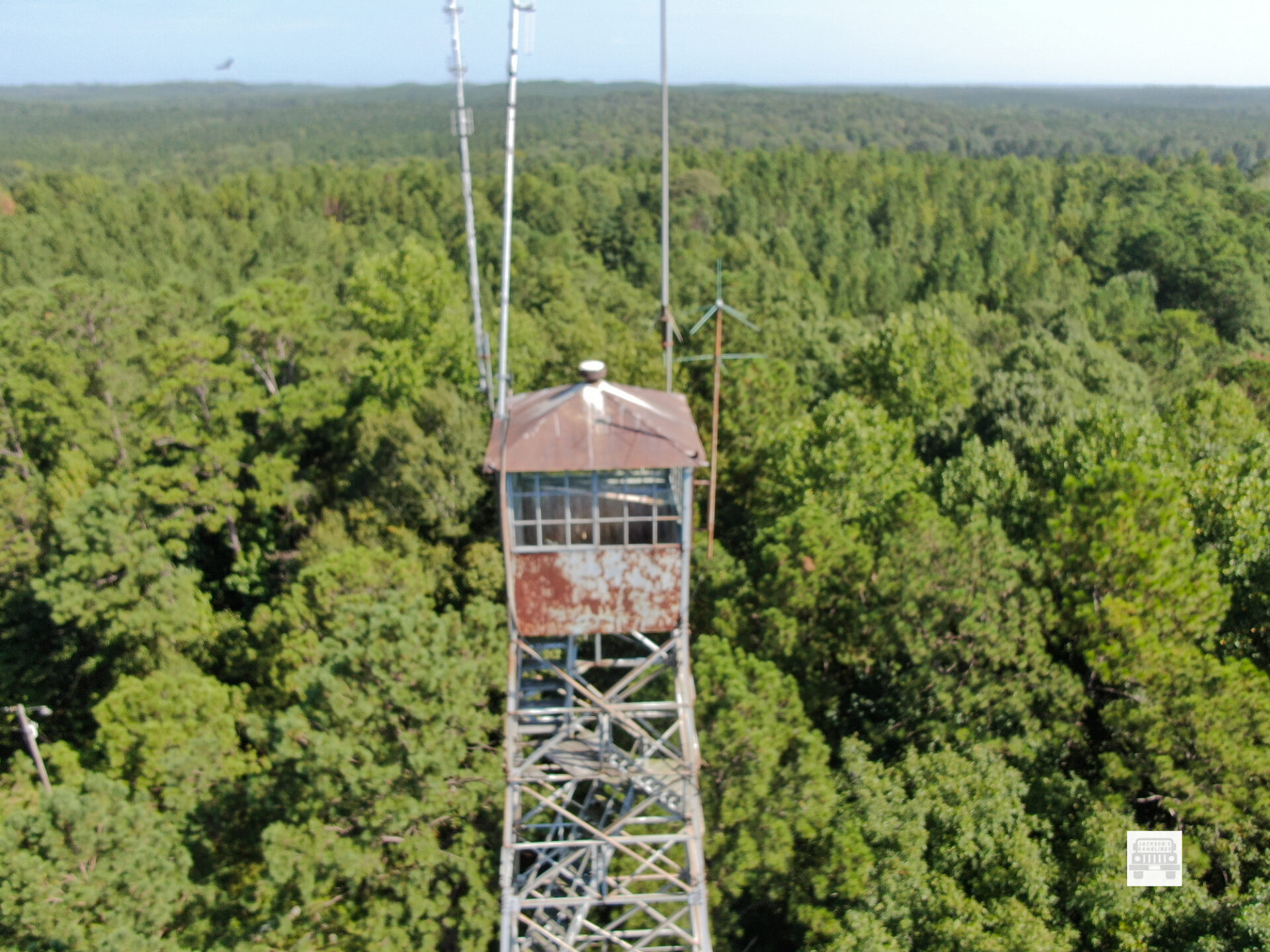
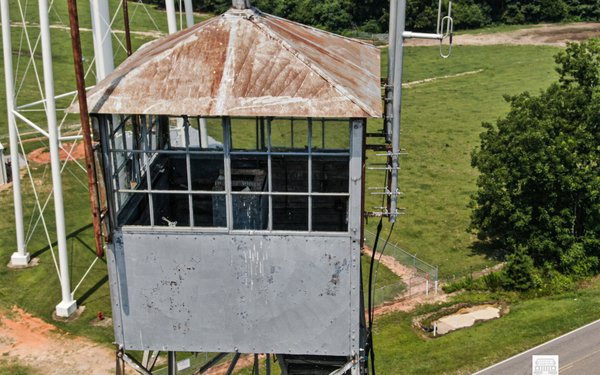
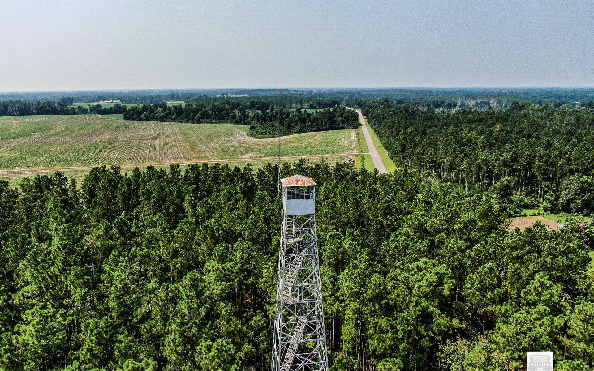
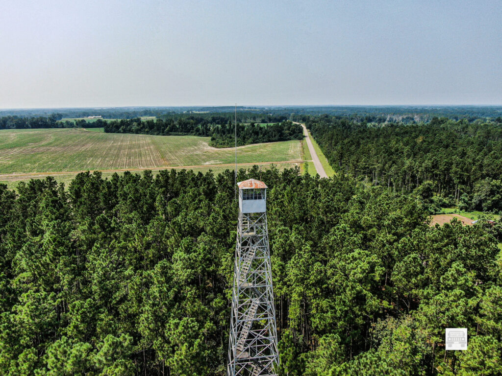
As most people know Forest Fire Lookouts is actually what got all of this started. Sort of.
I have been working on getting drone videos and pictures of them for years now. As most of you know it is my desire to document every one left standing in the State of Alabama. From the best of my estimation there are about 75 left.
Also to the best of my knowledge there have been only 4 that are South of US hwy 80 and West of I-65 that I have not been able to get to.
Two of those are behind gates and I have not successfully gotten the opportunity to get them. I just found out about one only a few weeks ago. That one is actually in the very Southern and Western most part of Mobile County. The fourth one has been up at Mt. Willing in Southern Lowndes County.
I have actually left home to get to Mt. Willing and for whatever reason never got there. You might say for me it has been elusive. I could not figure out exactly how to get to it even from the road. Now days so many roads that are few years ago were considered public roads are no longer open.
This morning I was coming across the area heading to Ft. Deposit and lo and behold I looked at my map and there was the pin for Mt. Willing Lookout Tower. I was going to be the closest to it I remember being.
I started looking at the maps as best I could trying to figure it out. Obviously when I needed it the most I did not have enough cell signal to figure it all out on the maps. I could figure out that I was not too far from it but could not figure out how to get to it.
Then all of a sudden as I was looking off in the distance I could see it. There was a short distance across a clear cut but was like a window I would say that the tree line broke and I could see it off in the distance from the road.
Now I hold a current FAA Part 107 certificate to fly drones. I knew I could fly it but I needed to be able to maintain visual line of sight. I stood there and looked and looked trying to decide. Finally I decided to give it a try. I knew it was a stretch but if I could not hold sight I could just return the drone and give up till I figure out a better way.
I parked beside the road. Laid the landing pad out, started the drone and controller, and calibrated the compass on it, and took off. It was bright. It was hard to see the controller in the sunlight. I could see the drone all the way.
One issue you have flying towers that far out is determining how close to the tower you really are. You are looking at a tiny screen in bright sunlight. Looking at the drone itself that far away it is just a dot basically and it is hard to look at two objects and determine exactly how far apart the really are.
default
default
At a thousand feet out or so it is hard to determine if. You are 50 feet away or you are about to hit it. My drone has obstacle avoidance in it. I brought it in to where the obstacle avoidance started reading the distance. I was able to get some decent photos and a short video of it.
Because of fear of losing sight of my drone I was not able to get as clear nor crisp pictures nor video as I do most towers. I was thankful though to get that one in the books as done.
The following information comes from the National Historical Lookout Registry:
The Mount Willing Lookout Tower in Lowndes County dates to 1936. The 100′ Aermotor MC-39 steel tower with 7’x7′ cab was built by CCC Company 4434, which was also a junior African-American unit.
Mt. Willing is: # 857 on the US Registry and #36 on the Alabama Registry.
It is located:
32°04’22.5″N 86°43’07.1″W
32.072903, -86.718627
I am thankful that I finally found it and got to take some pictures of it. I like to get closer and I like to make better photos. I will make a video when I get time. I actually have several I need to make videos of that I have taken the videos but not taken time to edit and put them up.